Geomatics for Environmental Monitoring: From Data to Services
26th Italian Conference, ASITA 2023, Virtual Event, December 18-20, 2023, Revised Selected Papers
Herausgegeben:Borgogno Mondino, Enrico; Zamperlin, Paola
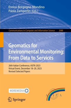
Geomatics for Environmental Monitoring: From Data to Services
26th Italian Conference, ASITA 2023, Virtual Event, December 18-20, 2023, Revised Selected Papers
Herausgegeben:Borgogno Mondino, Enrico; Zamperlin, Paola
- Broschiertes Buch
- Merkliste
- Auf die Merkliste
- Bewerten Bewerten
- Teilen
- Produkt teilen
- Produkterinnerung
- Produkterinnerung
This book constitutes the proceedings of the 26th Italian Conference on Geomatics for Environmental Monitoring: From Data to Services, ASITA 2023, which was held as a virtual event during December 18-20, 2023. The 19 full papers included in this book were carefully reviewed and selected from 42 submissions. They were organized in topical sections as follows: Natural hazards monitoring and modelling; technological services for territory planning and Management; methodological advancements in data analysis and processing.
Andere Kunden interessierten sich auch für
![Machine Learning and Principles and Practice of Knowledge Discovery in Databases Machine Learning and Principles and Practice of Knowledge Discovery in Databases]() Machine Learning and Principles and Practice of Knowledge Discovery in Databases64,99 €
Machine Learning and Principles and Practice of Knowledge Discovery in Databases64,99 €![Machine Learning and Principles and Practice of Knowledge Discovery in Databases Machine Learning and Principles and Practice of Knowledge Discovery in Databases]() Machine Learning and Principles and Practice of Knowledge Discovery in Databases67,99 €
Machine Learning and Principles and Practice of Knowledge Discovery in Databases67,99 €![Machine Learning and Principles and Practice of Knowledge Discovery in Databases Machine Learning and Principles and Practice of Knowledge Discovery in Databases]() Machine Learning and Principles and Practice of Knowledge Discovery in Databases64,99 €
Machine Learning and Principles and Practice of Knowledge Discovery in Databases64,99 €![Deep Learning Theory and Applications Deep Learning Theory and Applications]() Deep Learning Theory and Applications60,99 €
Deep Learning Theory and Applications60,99 €![Machine Learning and Principles and Practice of Knowledge Discovery in Databases Machine Learning and Principles and Practice of Knowledge Discovery in Databases]() Machine Learning and Principles and Practice of Knowledge Discovery in Databases67,99 €
Machine Learning and Principles and Practice of Knowledge Discovery in Databases67,99 €![Machine Learning and Principles and Practice of Knowledge Discovery in Databases Machine Learning and Principles and Practice of Knowledge Discovery in Databases]() Machine Learning and Principles and Practice of Knowledge Discovery in Databases65,99 €
Machine Learning and Principles and Practice of Knowledge Discovery in Databases65,99 €![Machine Learning, Image Processing, Network Security and Data Sciences Machine Learning, Image Processing, Network Security and Data Sciences]() Machine Learning, Image Processing, Network Security and Data Sciences60,99 €
Machine Learning, Image Processing, Network Security and Data Sciences60,99 €-
-
-
This book constitutes the proceedings of the 26th Italian Conference on Geomatics for Environmental Monitoring: From Data to Services, ASITA 2023, which was held as a virtual event during December 18-20, 2023.
The 19 full papers included in this book were carefully reviewed and selected from 42 submissions. They were organized in topical sections as follows: Natural hazards monitoring and modelling; technological services for territory planning and Management; methodological advancements in data analysis and processing.
The 19 full papers included in this book were carefully reviewed and selected from 42 submissions. They were organized in topical sections as follows: Natural hazards monitoring and modelling; technological services for territory planning and Management; methodological advancements in data analysis and processing.
Produktdetails
- Produktdetails
- Communications in Computer and Information Science 2088
- Verlag: Springer / Springer Nature Switzerland / Springer, Berlin
- Artikelnr. des Verlages: 978-3-031-59924-8
- 2024
- Seitenzahl: 316
- Erscheinungstermin: 28. Mai 2024
- Englisch
- Abmessung: 235mm x 155mm x 18mm
- Gewicht: 482g
- ISBN-13: 9783031599248
- ISBN-10: 3031599241
- Artikelnr.: 70291844
- Herstellerkennzeichnung
- Springer Nature c/o IBS
- Benzstrasse 21
- 48619 Heek
- Tanja.Keller@springer.com
.- Natural Hazards Monitoring and Modelling.
.- Advantages and limitations of satellite-based glacier monitoring. The Rutor Glacier in Italy.
.- A multi-scale approach to detect geomorphological hazard in a post-fire scenario: A case study in Sardinia (Central Mediterranean).
.- Measuring land deformation through PSI technique in NE Sardinia (Italy): Roads to Einstein Telescope.
.- A Low-Cost Three-Cameras Photogrammetric System for Training Students in Physical Simulation of Shallow Landslides.
.- The Italian National Fire and Rescue Service activity in forest fires: the event in Montegrino Valtravaglia.
.- Technological innovation in Emergency Technical Rescue: The deployment of CNVVF UAS to support the Director of Forest Fire Fighting Operation.
.- Platform prototype for the prediction of landslide risk susceptibility through a 4D WebGIS equipped with Cellular Automata and Neural Networks.
.- Technological Services for Territory Planning and Management.
.- A land monitoring service for local public administrations: the IRIDE EOS4LPA Lot 3 project.
.- Sen4MUN: a prototypal service for the distribution of contributions to the European municipalities from Copernicus satellite imagery. A case in Aosta Valley (NW Italy).
.- Monitoring and forecasting land cover dynamics using remote sensing and geospatial technology.
.- The QGIS platform for LABMET Observatory. The experience of the Metropolitan City of Cagliari (MCC).
.- The Digital Twin of the Metropolitan Area of Milan: quality assessment of aerial and terrestrial data.
.- On the Role of Geomatics in the Interconnected Nord-Est Innovation Ecosystem.
.- Methodological Advancements in Data Analysis and Processing.
.- Biodiversity-proof Energy Communities in the Urban Planning of Italian Inner Municipalities.
.- GIS Analysis for urban "anti-fragility" to climate change.
.- Next Pandemic Preparedness: A Focus on Health Data Standardization and Readiness for Spatial Enablement.
.- Towards a spatial decision support system for hydrogeological risk mitigation in railway sector.
.- Comparison between the vegetation indices obtained from Sentinel-2 and Planet: a case study over a rice farm in Northern Italy.
.- Classification of water in an urban environment by applying OBIA and fuzzy logic to very high-resolution satellite imagery.

