39,99 €
inkl. MwSt.
Versandkostenfrei*
Versandfertig in 1-2 Wochen
payback
20 °P sammeln
  • Broschiertes Buch

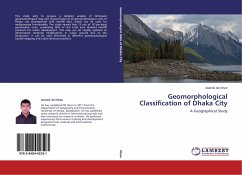
This study aims to prepare a detailed analysis of GIS-based geomorphological map and characteristics of all geomorphological units of Dhaka city accompanied with landfill sites, which can be used for multipurpose functionality. The study reveals that 13 out of 18 low-lying geomorphic units, comprising 65% of the total area demand landfill practices for urban development. This map can be rapidly updated to demonstrate temporal modifications in urban ground due to GIS integration. It can be used effectively in different geomorphological hazard mapping and urban land-use practices.

Produktbeschreibung
This study aims to prepare a detailed analysis of GIS-based geomorphological map and characteristics of all geomorphological units of Dhaka city accompanied with landfill sites, which can be used for multipurpose functionality. The study reveals that 13 out of 18 low-lying geomorphic units, comprising 65% of the total area demand landfill practices for urban development. This map can be rapidly updated to demonstrate temporal modifications in urban ground due to GIS integration. It can be used effectively in different geomorphological hazard mapping and urban land-use practices.
Hinweis: Dieser Artikel kann nur an eine deutsche Lieferadresse ausgeliefert werden.
Autorenporträt
He has completed BS Hon's in 2011 from the Department of Geography and Environment, University of Dhaka, Bangladesh. He has published many research articles in international journals and also interested on research activities. He gathered experiences from various training and development programs from national and international conferences.