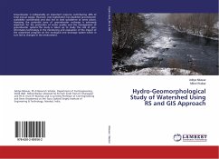
During the past decades rapid physical and chemical changes have taken place in glaciers of the Himalayan region. Hence, scope of studies of different geomorphological glacier features and landforms ie. erosional and depositional have been erased. The geomorphology of Himalayan glacier is changed due to different physical agent such as temperature, pressure, climatic factor etc. The present project deals with the "GEOMORPHOLOGICAL STUDIES OF HIMALAYAN GLACIERS". Work addresses the different climatic and physical factors which have been involved for the formation of different geomorphogical features of glaciers and its formations. Present study would be helpful to deciphering the importance of glaciers and its behaviour in respect of environmental and climate impact within the global context. Although detailed geomorphological studies of the Himalayan glaciers have not been studied due to short duration of time, but I hope that this project work is short summary to understand the basic geomorphological features of the Himalayan glacier region.
Bitte wählen Sie Ihr Anliegen aus.
Rechnungen
Retourenschein anfordern
Bestellstatus
Storno

