109,99 €
inkl. MwSt.
Versandkostenfrei*
Versandfertig in 1-2 Wochen
payback
55 °P sammeln
  • Broschiertes Buch

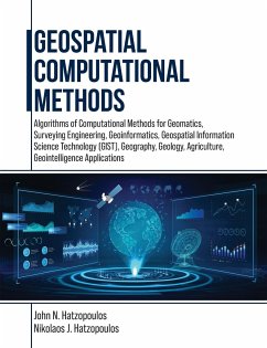
This book is for students and professionals involved in Geospatial Computations and related areas such as Geomatics, Surveying Engineering, Geoinformatics, Geospatial Information Science and Technology (GIS&T), Geography, Geology, Agriculture, and Geointelligence. More emphasis is given to using scientific methods and tools materialized in algorithms and software to produce practical results. Specifically, algorithms such as error analysis of measurements and the least squares adjustment method to obtain ground coordinates of points with their reliability to construct the geometric framework…mehr

Produktbeschreibung
This book is for students and professionals involved in Geospatial Computations and related areas such as Geomatics, Surveying Engineering, Geoinformatics, Geospatial Information Science and Technology (GIS&T), Geography, Geology, Agriculture, and Geointelligence. More emphasis is given to using scientific methods and tools materialized in algorithms and software to produce practical results. Specifically, algorithms such as error analysis of measurements and the least squares adjustment method to obtain ground coordinates of points with their reliability to construct the geometric framework of the geographical space necessary for various geospatial applications such as a Geographic Information System (GIS) are discussed. Other algorithms involve interpolation methods for DEM and spatial data analysis. Furthermore, such algorithms in the geospatial area are basic surveying methods using a total station, photogrammetry, digital terrain modeling, GNSS, augmented reality, coordinate transformations, map projections, and interpolation. Most algorithms are implemented into 27 educational computer programs and necessary data to understand GIS&T operations from the inside with a didactics approach targeting to become more intelligent than machines. The educational programs include general photogrammetric operations with aerial photography and drones, 3-D surveying network adjustment, GNSS navigation solutions, and many others. This approach helps to obtain high-quality scientific and technological bases, which in turn enhance the ability to exploit and use most tools and functions of existing GIS&T systems and, therefore, to be highly competitive as a professional in the market. This book has ten chapters such as Measurements and Errors Estimation and Accuracy Standards, Specialized Numerical Methods, Error Propagation & Least Squares Adjustment, Condition Method and Generalized Least Squares, Applications to Map Projections and Transformation of Coordinates, Applications to Surveying Networks, Applications of Computational Methods in Photogrammetry, Digital Elevation Models (DEM), Computer Programming--Scripting & AI.
Hinweis: Dieser Artikel kann nur an eine deutsche Lieferadresse ausgeliefert werden.
Autorenporträt
Professor John N. Hatzopoulos was born in Komiaki (Koronida) of Naxos, Greece. He graduated from the National Technical University of Athens (NTUA) in 1971 and received a diploma in Rural and Surveying Engineering, ranked first among 94 graduates. He was awarded a research assistantship at the University of Washington Seattle, USA, in 1975. He finished his MSCE degree in 1976 and his Ph.D. in 1979 while maintaining his research assistantship and working on various research projects in Photogrammetry and Remote Sensing. He was hired as an Associate Professor at the California State University Fresno (CSUF) Surveying Engineering program in 1980, and his contribution to the program was that it became one of the top programs in the USA. He was promoted to the rank of professor and got tenure in 1984. He worked at CSUF from 1980 to 1989. He resigned from CSUF and joined the Department of Environmental Studies at the University of Aegean, Greece, as a professor in 1989. Established the Laboratory of Remote Sensing and GIS at the University of Aegean and has been its Director since 1995. With the help of his colleagues, he also established the Extended University Program of Environmental Cartography and was the department's Chairman from 1998 to 2001. He retired in 2015, being awarded professor emeritus status. His activities involve teaching, research, and consulting in geomatic engineering, geospatial information science and technology, and computer-related applications. He has been a Member of the Technical Chamber of Greece since 1971 and of the ASPRS since 1976. He is a certified ASPRS photogrammetrist (1986) and a professional Rural and Surveying Engineer in Greece.