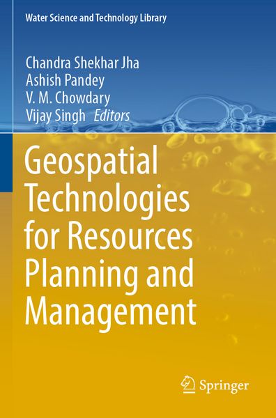
Geospatial Technologies for Resources Planning and Management
-
- Hardcover
- Taschenbuch ausgewählt
- eBook
-
Sprache:Englisch
148,99 €
UVP
171,19 €
inkl. gesetzl. MwSt.,
Beschreibung
Produktdetails
Einband
Taschenbuch
Erscheinungsdatum
26.05.2023
Abbildungen
VIII, 750 p. 378 illus., 351 illus. in color.
Herausgeber
Chandra Shekhar Jha + weitereVerlag
SpringerSeitenzahl
750
Maße (L/B/H)
23,5/15,5/4,1 cm
Gewicht
1130 g
Auflage
23001 Auflage 1st ed. 2022
Sprache
Englisch
ISBN
978-3-030-98983-5
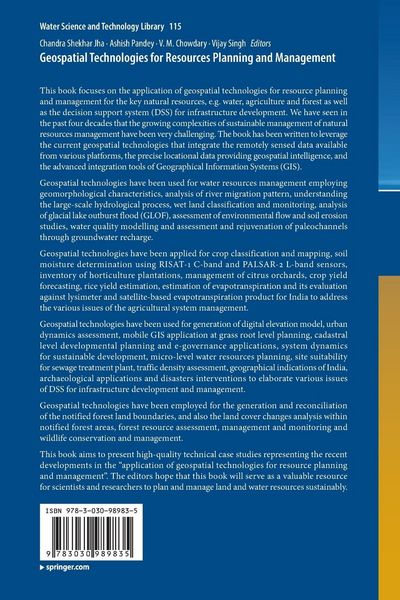
This book focuses on the application of geospatial technologies for resource planning and management for the key natural resources, e.g. water, agriculture and forest as well as the decision support system (DSS) for infrastructure development. We have seen in the past four decades that the growing complexities of sustainable management of natural resources management have been very challenging. The book has been written to leverage the current geospatial technologies that integrate the remotely sensed data available from various platforms, the precise locational data providing geospatial intelligence, and the advanced integration tools of Geographical Information Systems (GIS).
Geospatial technologies have been used for water resources management employing geomorphological characteristics, analysis of river migration pattern, understanding the large-scale hydrological process, wet land classification and monitoring, analysis of glacial lake outburst flood (GLOF), assessmentof environmental flow and soil erosion studies, water quality modelling and assessment and rejuvenation of paleochannels through groundwater recharge.
Geospatial technologies have been applied for crop classification and mapping, soil moisture determination using RISAT-1 C-band and PALSAR-2 L-band sensors, inventory of horticulture plantations, management of citrus orchards, crop yield forecasting, rice yield estimation, estimation of evapotranspiration and its evaluation against lysimeter and satellite-based evapotranspiration product for India to address the various issues of the agricultural system management.
Geospatial technologies have been used for generation of digital elevation model, urban dynamics assessment, mobile GIS application at grass root level planning, cadastral level developmental planning and e-governance applications, system dynamics for sustainable development, micro-level water resources planning, site suitability for sewage treatment plant,traffic density assessment, geographical indications of India, archaeological applications and disasters interventions to elaborate various issues of DSS for infrastructure development and management.Geospatial technologies have been employed for the generation and reconciliation of the notified forest land boundaries, and also the land cover changes analysis within notified forest areas, forest resource assessment, management and monitoring and wildlife conservation and management.
This book aims to present high-quality technical case studies representing the recent developments in the “application of geospatial technologies for resource planning and management”. The editors hope that this book will serve as a valuable resource for scientists and researchers to plan and manage land and water resources sustainably.
Noch keine Bewertungen vorhanden
Verfassen Sie die erste Bewertung zu diesem Artikel
Helfen Sie anderen Kundinnen und Kunden durch Ihre Meinung.
Kurze Frage zu unserer Seite
Vielen Dank für dein Feedback
Wir nutzen dein Feedback, um unsere Produktseiten zu verbessern. Bitte habe Verständnis, dass wir dir keine Rückmeldung geben können. Falls du Kontakt mit uns aufnehmen möchtest, kannst du dich aber gerne an unseren Kund*innenservice wenden.
zum Kundenservice