Geospatial Technologies in Land Resources Mapping, Monitoring and Management
Herausgegeben:Reddy, G. P. Obi; Singh, S. K.
Geospatial Technologies in Land Resources Mapping, Monitoring and Management
Herausgegeben:Reddy, G. P. Obi; Singh, S. K.
- Broschiertes Buch
- Merkliste
- Auf die Merkliste
- Bewerten Bewerten
- Teilen
- Produkt teilen
- Produkterinnerung
- Produkterinnerung
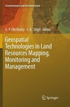
This book offers an overview of geospatial technologies in land resources mapping, monitoring and management. It consists of four main sections: geospatial technologies - principles and applications; geospatial technologies in land resources mapping; geospatial technologies in land resources monitoring; and geospatial technologies in land resources management. Each part is divided into detailed chapters that include illustrations and tables. The authors, from leading institutes, such as the ICAR-NBSS&LUP, IIT-B, NRSC, ICRISAT, share their experiences and offer case studies to provide advanced…mehr
Andere Kunden interessierten sich auch für
![Geospatial Technologies in Land Resources Mapping, Monitoring and Management Geospatial Technologies in Land Resources Mapping, Monitoring and Management]() Geospatial Technologies in Land Resources Mapping, Monitoring and Management113,99 €
Geospatial Technologies in Land Resources Mapping, Monitoring and Management113,99 €![Geospatial Technologies in Geography Education Geospatial Technologies in Geography Education]() Geospatial Technologies in Geography Education75,99 €
Geospatial Technologies in Geography Education75,99 €![Smart Growth and Sustainable Development Smart Growth and Sustainable Development]() Smart Growth and Sustainable Development38,99 €
Smart Growth and Sustainable Development38,99 €![Environment and Earth Observation Environment and Earth Observation]() Environment and Earth Observation104,99 €
Environment and Earth Observation104,99 €![Geospatial Technologies for Local and Regional Development Geospatial Technologies for Local and Regional Development]() Geospatial Technologies for Local and Regional Development112,99 €
Geospatial Technologies for Local and Regional Development112,99 €![Geospatial Technologies in Geography Education Geospatial Technologies in Geography Education]() Geospatial Technologies in Geography Education104,99 €
Geospatial Technologies in Geography Education104,99 €![Geo-Topology Geo-Topology]() Fivos PapadimitriouGeo-Topology104,99 €
Fivos PapadimitriouGeo-Topology104,99 €-
-
-
This book offers an overview of geospatial technologies in land resources mapping, monitoring and management. It consists of four main sections: geospatial technologies - principles and applications; geospatial technologies in land resources mapping; geospatial technologies in land resources monitoring; and geospatial technologies in land resources management. Each part is divided into detailed chapters that include illustrations and tables. The authors, from leading institutes, such as the ICAR-NBSS&LUP, IIT-B, NRSC, ICRISAT, share their experiences and offer case studies to provide advanced insights into the field. It is a valuable resource for the scientific and the teaching community, extension scientists at research institutes and agricultural universities/colleges as well as those involved in planning and managing land resources for sustainable agriculture and livelihood security.
Produktdetails
- Produktdetails
- Geotechnologies and the Environment 21
- Verlag: Springer / Springer International Publishing / Springer, Berlin
- Artikelnr. des Verlages: 978-3-030-08770-8
- Softcover reprint of the original 1st edition 2018
- Seitenzahl: 668
- Erscheinungstermin: 10. Januar 2019
- Englisch
- Abmessung: 235mm x 155mm x 36mm
- Gewicht: 1009g
- ISBN-13: 9783030087708
- ISBN-10: 3030087700
- Artikelnr.: 57586995
- Herstellerkennzeichnung Die Herstellerinformationen sind derzeit nicht verfügbar.
Dr. G.P. Obi Reddy obtained his doctoral degree in Geography from Sri Krishnadevaraya University, Anantapur, India and presently working as Principal Scientist & Incharge, GIS & Cartography Sections, Division of Remote Sensing Application, ICAR-National Bureau of Soil Survey and Land Use Planning (NBSS&LUP), Nagpur, India. His major research areas are remote sensing and GIS applications in: Applied geomorphology, digital terrain analysis, landform mapping, soil-landscape modelling, land use/land cover studies, watershed development, design and development of soil resource systems and Geoportal. He has published more than 80 research articles in peer-reviewed national and international journals, 3 books, 30 book chapters and 10 technical bulletins. He is the recipient of Indian National Geospatial Award-2007, National Geospatial Award for Excellence-2013 and five best poster presentation awards. He has acted as reviewer for many national and international journals. Dr. S.K. Singh obtained his doctoral degree in Soil Science from Rajasthan Agriculture University, Bikaner and presently working as Director at ICAR-National Bureau of Soil Survey and Land Use Planning (NBSS&LUP), Nagpur, India. His major research areas are soil resource inventory, soil nutrient mapping, desertification and carbon sequestration, land use planning and remote sensing GIS applications. He significantly contributed in development of GIS based soil nutrient mapping for Eastern Region, development of Farmer's Advisory for the state of West Bengal and soil resource inventory for more than 100 blocks in India on 1:10,000 scale. He is the recipient of Shriram Award (2012) instituted by FAI, New Delhi, India. He has published more than 115 research articles, 4 books, 30 book chapters and 50 technical bulletins. He has acted as reviewer for many national and international journals.
Part I: Geospatial Technologies - Principles and Applications.- Chapter 1. Principles and applications of geospatial technologies (G.P. Obi Reddy).- Chapter 2. Advances in multi-sensor satellite data processing and applications ( Nirmal Kumar).- Chapter 3. High resolution remote sensing data characteristics and applications (M.S.S. Nagaraju).- Chapter 4. Advances in digital image processing for resources mapping (G.P. Obi Reddy).- Chapter 5. Principles of Geographical Information and Communication Technologies (J. Adinarayana).- Chapter 6. Principles of geostatistics in spatial data analysis and mapping (Nirmal Kumar).- Part II: Geospatial Technologies in Land Resources Mapping.- Chapter 7. Land resource inventory and mapping- issues and challenges (S.K. Singh).- Chapter 8. Remote sensing and GIS for development of baseline database (S. Chattaraj).- Chapter 9. Geospatial technologies in geomorphological mapping (G.P. Obi Reddy).- Chapter 10. Pedogeomorphic analysis in land resource inventory (P.B. Bhaskar).- Chapter 11. GIS and remote sensing in digital terrain analysis (G.P. Obi Reddy).- Chapter 12. Remote sensing applications in large-scale mapping (M.S.S. Nagaraju).- Chapter 13. Remote sensing applications in land resource inventory (Rajeev Srivastava).- Chapter 14. Land resource inventory for block level planning (Jagdish Prasad).- Chapter 15. Land resource mapping for village level planning (Nisha Sahu).- Chapter 16. Applications of hyperspectral remote sensing in soils (Rajeev Srivastava).- Part III: Geospatial Technologies in Land Resources Monitoring.- Chapter 17. Remote sensing and GIS for land resource monitoring (Jugal Kishore Mani).- Chapter 18. Remote sensing for land resource monitoring and management (Suresh Kumar).- Chapter 19. GIS for development and analysis of geospatial databases (G.P. Obi Reddy).- Chapter 20. Development ofSoil Information System in SOTER (P. Chandran).- Chapter 21. Development of Soil Information System and Geoportal-Issues and challenges (G.P. Obi Reddy).- Chapter 22. Geospatial applications in water resource management (Y.B. Katpatal).- Chapter 23. Remote sensing for cropland monitoring and management (G. Muralikrishna).- Part IV: Geospatial Technologies in Land Resources Management.- Chapter 24. Remote sensing and GIS applications in micro level planning (G. Srinivasam).- Chapter 25. Trends in Geo-ICDT applications in agriculture (J. Adinarayana).- Chapter 26. Advances in land resources management for land use planning - issues and challenges (T.K. Sen).- Chapter 27. Remote Sensing and GIS in Land Use Planning-Issues and challenges (A. Chaturvedi).- Chapter 28. Land resource mapping for village level planning (Nisha Sahu).- Chapter 29. Trends in Soil based land use planning-Impacts on livelihood security (V. Ramamurthy).- Chapter 30. Geospatial applications in micro-level planning (S.N. Das).
Part I: Geospatial Technologies - Principles and Applications.- Chapter 1. Principles and applications of geospatial technologies (G.P. Obi Reddy).- Chapter 2. Advances in multi-sensor satellite data processing and applications ( Nirmal Kumar).- Chapter 3. High resolution remote sensing data characteristics and applications (M.S.S. Nagaraju).- Chapter 4. Advances in digital image processing for resources mapping (G.P. Obi Reddy).- Chapter 5. Principles of Geographical Information and Communication Technologies (J. Adinarayana).- Chapter 6. Principles of geostatistics in spatial data analysis and mapping (Nirmal Kumar).- Part II: Geospatial Technologies in Land Resources Mapping.- Chapter 7. Land resource inventory and mapping- issues and challenges (S.K. Singh).- Chapter 8. Remote sensing and GIS for development of baseline database (S. Chattaraj).- Chapter 9. Geospatial technologies in geomorphological mapping (G.P. Obi Reddy).- Chapter 10. Pedogeomorphic analysis in land resource inventory (P.B. Bhaskar).- Chapter 11. GIS and remote sensing in digital terrain analysis (G.P. Obi Reddy).- Chapter 12. Remote sensing applications in large-scale mapping (M.S.S. Nagaraju).- Chapter 13. Remote sensing applications in land resource inventory (Rajeev Srivastava).- Chapter 14. Land resource inventory for block level planning (Jagdish Prasad).- Chapter 15. Land resource mapping for village level planning (Nisha Sahu).- Chapter 16. Applications of hyperspectral remote sensing in soils (Rajeev Srivastava).- Part III: Geospatial Technologies in Land Resources Monitoring.- Chapter 17. Remote sensing and GIS for land resource monitoring (Jugal Kishore Mani).- Chapter 18. Remote sensing for land resource monitoring and management (Suresh Kumar).- Chapter 19. GIS for development and analysis of geospatial databases (G.P. Obi Reddy).- Chapter 20. Development ofSoil Information System in SOTER (P. Chandran).- Chapter 21. Development of Soil Information System and Geoportal-Issues and challenges (G.P. Obi Reddy).- Chapter 22. Geospatial applications in water resource management (Y.B. Katpatal).- Chapter 23. Remote sensing for cropland monitoring and management (G. Muralikrishna).- Part IV: Geospatial Technologies in Land Resources Management.- Chapter 24. Remote sensing and GIS applications in micro level planning (G. Srinivasam).- Chapter 25. Trends in Geo-ICDT applications in agriculture (J. Adinarayana).- Chapter 26. Advances in land resources management for land use planning - issues and challenges (T.K. Sen).- Chapter 27. Remote Sensing and GIS in Land Use Planning-Issues and challenges (A. Chaturvedi).- Chapter 28. Land resource mapping for village level planning (Nisha Sahu).- Chapter 29. Trends in Soil based land use planning-Impacts on livelihood security (V. Ramamurthy).- Chapter 30. Geospatial applications in micro-level planning (S.N. Das).

