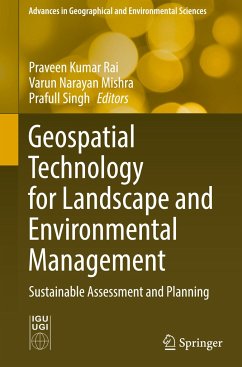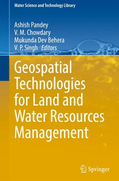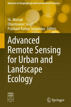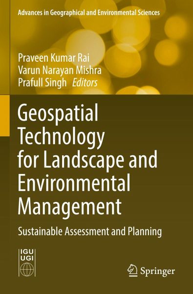
Geospatial technology is a combination of state-of-the-art remote sensing and technology for geographic information systems (GIS) and global navigation satellite systems (GNSS) for the mapping and monitoring of landscapes and environment. The main thrust of using geospatial technology is to understand the causes, mechanisms, and consequences of spatial heterogeneity, while its ultimate objective is to provide a scientific basis for developing and maintaining ecologically, economically, and socially sustainable landscapes. This book presents new research on the interdisciplinary applications of…mehr
Geospatial technology is a combination of state-of-the-art remote sensing and technology for geographic information systems (GIS) and global navigation satellite systems (GNSS) for the mapping and monitoring of landscapes and environment. The main thrust of using geospatial technology is to understand the causes, mechanisms, and consequences of spatial heterogeneity, while its ultimate objective is to provide a scientific basis for developing and maintaining ecologically, economically, and socially sustainable landscapes. This book presents new research on the interdisciplinary applications of geospatial technology for identification, assessment, monitoring, and modelling issues related to landscape, natural resources, and environmental management. The book specifically focuses on the creation, collection, storage, processing, modelling, interpretation, display, and dissemination of spatio-temporal data, which help to resolve environmental management issues including ecosystem change,resource utilization, land use management, and environmental pollution. The positive environmental impacts of information technology advancements with regard to global environmental and climate change are also discussed. The book addresses the interests of a wide spectrum of readers who have a common interest in geospatial science, geology, water resource management, database management, planning and policy making, and resource management.
Produktdetails
Produktdetails
Advances in Geographical and Environmental Sciences
Dr. Praveen Kumar Rai is an associate professor in the Department of Geography, Khwaja Moinuddin Chishti Language University, Lucknow, Uttar Pradesh, India. He has more than 13 years of teaching and research experience in the field of remote sensing and GIS. He completed his M.Sc. in geography, specializing in remote sensing, in Banaras Hindu University, India, in 2006 and an M.Tech. and Ph.D. in remote sensing in the Birla Institute of Technology, Mesra, India, in 2008 and 2013, respectively. His research interests include remote sensing and GIS, glaciology, health and disease modelling, disaster management, and water resource management, among other areas. He has published more than 65 research papers in international and national journals of repute and also has published 4 books in various applications of remote sensing and GIS. He has visited many countries to present invited lectures as keynote speaker. He has also served as an editorial board member and as a reviewer for many international journals. Dr. Varun Narayn Mishra is an assistant professor in the Centre for Climate Change and Water Research, Suresh Gyan Vihar University, Jaipur, India. He completed his M.Sc. degree in physics from Veer Bahadur Singh Purvanchal University, Jaunpur and M.Tech. degree in remote sensing from Birla Institute of Technology, Mesra, Ranchi, India. He was awarded his Ph.D. degree from the Department of Physics, Indian Institute of Technology (BHU), Varanasi. Previously he worked as a project fellow in Centre for the Study of Regional Development, Jawaharlal Nehru University, New Delhi under Department of Science and Technology funded research project. He has published more than 40 research papers in various international journals of repute and 5 books on the applications of remote sensing and GIS. He is also reviewer of many reputed journals published by Springer, Elsevier, Taylor & Francis, among others Dr. Prafull Singhis an associate professor in the Department of Geology, School of Earth, Biological and Environmental Sciences of the Central University of South Bihar. He has more than 12 years of teaching and research experience. He won the Department of Science and Technology (DST) Young Scientist Award and completed one Science and Engineering Research Board (SERB) - DST project as the principal investigator. He received a European Union Fellowship to visit the University of Salzburg, Austria, as a visiting professor. He was also awarded the Certificate of Appreciation in Shikshak Samman Samaroh, organized by the Rashtriya Shaikshik Mahasangh, Uttar Pradesh, India. Dr. Singh has extensive research experience in the fields of natural disaster, water resources, groundwater recharge and prospect modeling, urban environmental monitoring, and landslide and remote sensing applications in earth and environmental sciences. He has published more than 50 international research papers in journals in the field of earth, environment, and hydrology and has more than 750 citations, with an h-Index of 15. He has supervised many Ph.D. and postgraduate-level students, and he has served as a reviewer for most international journals in the field of water resources, earth sciences, and natural hazards.
Inhaltsangabe
Spatio-temporal variability of channel planform dynamics in response to spatial expansion of brick kilns: a case study of the downstream course of Ichamati River, West Bengal, India.- Assessment of replenishable groundwater resource and integrated water resource planning for sustainable agriculture.- Spatial prediction of flood frequency analysis in a semi-arid zone: A case study from the Seyad basin (Guelmim Region, Morocco).- Geospatial modeling in the assessment of environmental resources for sustainable water resource management in a Gondia district, India.- Hydrochemical characteristics of groundwater-assessment of saltwater intrusion along Krishna Godavari Delta Region, Andhra Pradesh, India.- Micro level planning for integrated natural resources management and sustainable development: an approach through a micro watershed using geospatial technology.- Ecohydrological perspective for environmental degradation of lakes and wetlands in Delhi.- Prioritization and quantitative assessment of Dhundsir Gad using RS and GIS: implications for watershed management, planning and conservation, Garhwal Himalaya, Uttarakhand.- Assessment of groundwater potential zones and resource sustainability through Geospatial Techniques: a case study of Kamina sub-watershed of Bhima River Basin, Maharashtra, India.- Morphometric analysis of Damodar River sub-watershed, Jharkhand, India, using remote sensing and GIS techniques.- The increasing inevitability of IOT in remote disaster monitoring applications.- Countering challenges of smart cities mission through participatory approach.- Urban growth modelling and prediction of land use land cover change over Nagpur city, India using Cellular automata approach.- Slum categorization for efficient development plan - a case study of Udhampur city, J&K using Remote sensing and GIS.- Urban growth trend analysis using Shannon Entropy approach - A case study of Dehradun City of Uttarakhand, India.- Geospatial approach for mapping of significant land use / land cover changes in Andhra Pradesh.- Assessing the impact of Delhi metro network towards urbanization of Delhi-NCR.- Analysis of urban heat island effect in the Rajkot city using Geospatial Techniques.- Multi spectral remote sensing for urban planning and development.- Analysis Of urban green spaces using geospatial techniques-a case study of Vijayawada urban local body Andhra Pradesh, India.- Magnetic susceptibility and heavy metals contamination in agricultural soil of Kopargaon Area, Ahmadnagar District, Maharashtra, India.
Es gelten unsere Allgemeinen Geschäftsbedingungen: www.buecher.de/agb
Impressum
www.buecher.de ist ein Internetauftritt der buecher.de internetstores GmbH
Geschäftsführung: Monica Sawhney | Roland Kölbl | Günter Hilger
Sitz der Gesellschaft: Batheyer Straße 115 - 117, 58099 Hagen
Postanschrift: Bürgermeister-Wegele-Str. 12, 86167 Augsburg
Amtsgericht Hagen HRB 13257
Steuernummer: 321/5800/1497
USt-IdNr: DE450055826