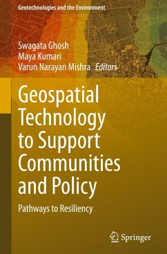
Geospatial Technology to Support Communities and Policy
Pathways to Resiliency
Herausgegeben:Ghosh, Swagata; Kumari, Maya; Mishra, Varun Narayan
Geospatial Technology to Support Communities and Policy
Pathways to Resiliency
Herausgegeben:Ghosh, Swagata; Kumari, Maya; Mishra, Varun Narayan
- Gebundenes Buch
- Merkliste
- Auf die Merkliste
- Bewerten Bewerten
- Teilen
- Produkt teilen
- Produkterinnerung
- Produkterinnerung
This book covers theoretical concepts of climate change related phenomena, different components of geospatial technology and application of geospatial technology on analysis of climate changes. Besides the book will also cover different characteristics of climate resilience, how resilience relates to the adaptation and mitigation and role of geospatial science, techniques, and tools in building climate resilience of a society. This text is suitable for researchers, academicians, urban planners, environmentalists, policy makers, scientists, ecologists, administrators etc.
Andere Kunden interessierten sich auch für
![Geospatial Technology for Landscape and Environmental Management Geospatial Technology for Landscape and Environmental Management]() Geospatial Technology for Landscape and Environmental Management119,99 €
Geospatial Technology for Landscape and Environmental Management119,99 €![Geospatial Technology for Landscape and Environmental Management Geospatial Technology for Landscape and Environmental Management]() Geospatial Technology for Landscape and Environmental Management119,99 €
Geospatial Technology for Landscape and Environmental Management119,99 €![Geospatial Infrastructure, Applications and Technologies: India Case Studies Geospatial Infrastructure, Applications and Technologies: India Case Studies]() Geospatial Infrastructure, Applications and Technologies: India Case Studies75,99 €
Geospatial Infrastructure, Applications and Technologies: India Case Studies75,99 €![Geospatial Technologies for Land and Water Resources Management Geospatial Technologies for Land and Water Resources Management]() Geospatial Technologies for Land and Water Resources Management119,99 €
Geospatial Technologies for Land and Water Resources Management119,99 €![Geospatial Technologies for Land and Water Resources Management Geospatial Technologies for Land and Water Resources Management]() Geospatial Technologies for Land and Water Resources Management119,99 €
Geospatial Technologies for Land and Water Resources Management119,99 €![Applied Geography and Geoinformatics for Sustainable Development Applied Geography and Geoinformatics for Sustainable Development]() Applied Geography and Geoinformatics for Sustainable Development127,99 €
Applied Geography and Geoinformatics for Sustainable Development127,99 €![Geospatial Data Analytics and Urban Applications Geospatial Data Analytics and Urban Applications]() Geospatial Data Analytics and Urban Applications49,99 €
Geospatial Data Analytics and Urban Applications49,99 €-
-
-
This book covers theoretical concepts of climate change related phenomena, different components of geospatial technology and application of geospatial technology on analysis of climate changes. Besides the book will also cover different characteristics of climate resilience, how resilience relates to the adaptation and mitigation and role of geospatial science, techniques, and tools in building climate resilience of a society. This text is suitable for researchers, academicians, urban planners, environmentalists, policy makers, scientists, ecologists, administrators etc.
Hinweis: Dieser Artikel kann nur an eine deutsche Lieferadresse ausgeliefert werden.
Hinweis: Dieser Artikel kann nur an eine deutsche Lieferadresse ausgeliefert werden.
Produktdetails
- Produktdetails
- Geotechnologies and the Environment 26
- Verlag: Springer / Springer Nature Switzerland / Springer, Berlin
- Artikelnr. des Verlages: 978-3-031-52560-5
- 2024
- Seitenzahl: 356
- Erscheinungstermin: 27. Februar 2024
- Englisch
- Abmessung: 241mm x 160mm x 25mm
- Gewicht: 699g
- ISBN-13: 9783031525605
- ISBN-10: 3031525604
- Artikelnr.: 69638055
- Herstellerkennzeichnung
- Springer Nature c/o IBS
- Benzstrasse 21
- 48619 Heek
- Tanja.Keller@springer.com
Dr. Swagata Ghosh, is currently working as an Assistant Professor in the Department of Geography, Central University of Karnataka, India. She received her M.Sc. in Geography from the University of Calcutta, and her M.Tech. and Ph.D. in Remote Sensing from Birla Institute of Technology Mesra, Ranchi. She has been working in various areas of Remote Sensing applications viz. urban growth modelling, urban heat island, air pollution modelling, snow and glacier studies etc. She has published research articles in reputed international journals, book chapters, and articles in conference proceedings. Dr. Ghosh is a recipient of the Early Career Research Award (ECRA) and received research funding from the Science and Engineering Research Board (SERB), Govt. of India. Dr. Ghosh also received Erasmus+ Grant under an International grant to visit the University of Salzburg, Austria as Visiting Professor. Dr. Maya Kumari is currently working as Assistant Professor at Amity University Uttar Pradesh. She has done her Doctoral degree from Guru Gobind Singh Indraprastha University, New Delhi and M.Tech in Remote Sensing technology from Birla Institute of Technology, Mesra, Ranchi. She also has done master's degree in Environmental Science from Banaras Hindu University, Varanasi, India. She has 13 years of teaching and research experience in GIS and Remote Sensing. Her specialization is the theory and practice of global positioning and navigation system, digital image processing, application of Remote Sensing in Environment & natural resource management and spatial data modeling. She has published several research papers in national and international conferences/journals related to the field of Remote Sensing and GIS. Dr. Varun Narayan Mishra is currently working as an Assistant Professor at Amity University, Noida, India. He completed doctorate from Indian Institute of Technology (BHU), Varanasi and M.Tech. in Remote Sensing from BirlaInstitute of Technology, Mesra, Ranchi, after completing M.Sc. degree in Physics. He is an experienced researcher with a demonstrated history of teaching in the field of remote sensing & GIS, spatial data analysis and modelling, digital image processing, AI & ML. His main research interests are Radar remote sensing, SAR interferometry, land change simulation & modelling, landslides and flood susceptibility modelling, vulnerability, and risk assessment. He has published several research papers in various reputed international peer reviewed journals. He also authored many edited books, reference books and book chapters with reputed publishers.
1. Insights into the Multifaceted Application of Technology to Empower Disaster Resilience: A Geospatial Perspective (Swagata Ghosh, Maya Kumari, Varun Narayan Mishra).- 2. River Conservation and Water Resource Management (Prameena Sheeja J.L, Priyanka N, G.Bhaskaran).- 3. Morphometric Analysis for Prioritizing Sub-watersheds of Chulband River basin, India, using Geospatial Techniques (Padala Raja Shekar, Aneesh Mathew).- 4. A GIS Based Study of the Effects of Groundwater, Soil Quality and Rainfall on Agriculture in Bagh River Basin, India (Nanabhau Kudnar, Varun Narayan Mishra, Devendra Bisen, Vasudev Salunke, Ravindra Bhagat).- 5. Statistical Approach to Visualize the Seven-Decadal Rainfall Variation as response to Climate Change in a semiarid region of Karnataka, India (Sanjay Kumar, Krishna Kumar S, S. A. Ahmed, Jyothika Karkala).- 6. AI-based Rainfall-Runoff Modelling for Sustainable Water Management in Potteruvagu Watershed, India (Padala Raja Shekar, Aneesh Mathew).- 7. Building Flood Resilience through Flood Risk Assessment with Optical and Microwave Remote Sensing (Kumar Rajeev).- 8. Satellite Image-Based Drought Monitoring, -Vision to Enhance Drought Resilience (S.L. Borana, S.K.Yadav).- 9. The Power of Machine Learning in Forest Fire Risk Analysis and Resilience: Navigating Best Practices, Challenges, and Opportunities (Atharva Awatade, Pratap Pawar, Lakshmi D).- 10. Machine Learning for forest fire Risk and Resilience (Smita Varma, Soumendu Shekar Roy, Praveen Kumar Rai).- 11. Advanced Application of Unmanned Aerial Vehicle (UAV) for Rapid Surveying and Mapping: A case study from Maharashtra, India (Nandakishore, Swati Sharma, Avaneesh Kumar).- 12. Application of Digital Technologies & Remote Sensing In Precision Agriculture for Sustainable Crop Production (Mohammad Usama).- 13. Advances in Soil Resource Management in Geoinformatics Domain: A Comprehensive Review (Ragini Kumari, B.K. Vimal, Praveen Kumar Rai, Sunita Paswan, Rahul Kumar Misra).- 14. Smart Village Planning towards Sustainability using Geospatial techniques-A case study of Muzaffarnagar district, India (Gaurav Tripathi, Ritambhara Kumari Upadhyay, Chandra Shekhar Dwivedi, Achala Shakya).- 15. A Review of Spatial Analysis Techniques Used for LULC Change Detection Over Delhi NCR in the Past Two Decades (Yashvita Tamrakar, Swati Sharma).- 16. Assessment of Spatial and Temporal Changes in Strength of Vegetation using Normalized Difference Vegetation Index (NDVI) and Enhanced Vegetation Index (EVI): A Case Study from Akola District, Central India (Abhijeet Ambadkar, Pranali Kathe, Chaitanya Pande, Pranaya Diwate).- 17. Particle Pollution and Health - Risk and Resilience Evaluation (Ambrina Sardar Khan, Prateek Srivastava).- 18. Resilience & Vulnerability: Concepts and Policy Contexts (Ambrina Sardar Khan, Prateek Srivastava).
1. Insights into the Multifaceted Application of Technology to Empower Disaster Resilience: A Geospatial Perspective (Swagata Ghosh, Maya Kumari, Varun Narayan Mishra).- 2. River Conservation and Water Resource Management (Prameena Sheeja J.L, Priyanka N, G.Bhaskaran).- 3. Morphometric Analysis for Prioritizing Sub-watersheds of Chulband River basin, India, using Geospatial Techniques (Padala Raja Shekar, Aneesh Mathew).- 4. A GIS Based Study of the Effects of Groundwater, Soil Quality and Rainfall on Agriculture in Bagh River Basin, India (Nanabhau Kudnar, Varun Narayan Mishra, Devendra Bisen, Vasudev Salunke, Ravindra Bhagat).- 5. Statistical Approach to Visualize the Seven-Decadal Rainfall Variation as response to Climate Change in a semiarid region of Karnataka, India (Sanjay Kumar, Krishna Kumar S, S. A. Ahmed, Jyothika Karkala).- 6. AI-based Rainfall-Runoff Modelling for Sustainable Water Management in Potteruvagu Watershed, India (Padala Raja Shekar, Aneesh Mathew).- 7. Building Flood Resilience through Flood Risk Assessment with Optical and Microwave Remote Sensing (Kumar Rajeev).- 8. Satellite Image-Based Drought Monitoring, -Vision to Enhance Drought Resilience (S.L. Borana, S.K.Yadav).- 9. The Power of Machine Learning in Forest Fire Risk Analysis and Resilience: Navigating Best Practices, Challenges, and Opportunities (Atharva Awatade, Pratap Pawar, Lakshmi D).- 10. Machine Learning for forest fire Risk and Resilience (Smita Varma, Soumendu Shekar Roy, Praveen Kumar Rai).- 11. Advanced Application of Unmanned Aerial Vehicle (UAV) for Rapid Surveying and Mapping: A case study from Maharashtra, India (Nandakishore, Swati Sharma, Avaneesh Kumar).- 12. Application of Digital Technologies & Remote Sensing In Precision Agriculture for Sustainable Crop Production (Mohammad Usama).- 13. Advances in Soil Resource Management in Geoinformatics Domain: A Comprehensive Review (Ragini Kumari, B.K. Vimal, Praveen Kumar Rai, Sunita Paswan, Rahul Kumar Misra).- 14. Smart Village Planning towards Sustainability using Geospatial techniques-A case study of Muzaffarnagar district, India (Gaurav Tripathi, Ritambhara Kumari Upadhyay, Chandra Shekhar Dwivedi, Achala Shakya).- 15. A Review of Spatial Analysis Techniques Used for LULC Change Detection Over Delhi NCR in the Past Two Decades (Yashvita Tamrakar, Swati Sharma).- 16. Assessment of Spatial and Temporal Changes in Strength of Vegetation using Normalized Difference Vegetation Index (NDVI) and Enhanced Vegetation Index (EVI): A Case Study from Akola District, Central India (Abhijeet Ambadkar, Pranali Kathe, Chaitanya Pande, Pranaya Diwate).- 17. Particle Pollution and Health - Risk and Resilience Evaluation (Ambrina Sardar Khan, Prateek Srivastava).- 18. Resilience & Vulnerability: Concepts and Policy Contexts (Ambrina Sardar Khan, Prateek Srivastava).

