- Broschiertes Buch
- Merkliste
- Auf die Merkliste
- Bewerten Bewerten
- Teilen
- Produkt teilen
- Produkterinnerung
- Produkterinnerung
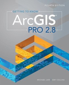
Getting to Know ArcGIS Pro 2.8Â is a textbook and desk reference designed to show users how they can use ArcGIS Pro successfully on their own.
Andere Kunden interessierten sich auch für
![GIS Tutorial for ArcGIS Pro 2.8 GIS Tutorial for ArcGIS Pro 2.8]() Wilpen L. GorrGIS Tutorial for ArcGIS Pro 2.8106,99 €
Wilpen L. GorrGIS Tutorial for ArcGIS Pro 2.8106,99 €![Top 20 Essential Skills for ArcGIS Pro Top 20 Essential Skills for ArcGIS Pro]() Bonnie ShrewsburyTop 20 Essential Skills for ArcGIS Pro45,99 €
Bonnie ShrewsburyTop 20 Essential Skills for ArcGIS Pro45,99 €![GIS Tutorial for ArcGIS Pro 3.1 GIS Tutorial for ArcGIS Pro 3.1]() Wilpen L. GorrGIS Tutorial for ArcGIS Pro 3.1105,99 €
Wilpen L. GorrGIS Tutorial for ArcGIS Pro 3.1105,99 €![Top 20 Essential Skills for ArcGIS Online Top 20 Essential Skills for ArcGIS Online]() Craig CarpenterTop 20 Essential Skills for ArcGIS Online44,99 €
Craig CarpenterTop 20 Essential Skills for ArcGIS Online44,99 €![Getting to Know ArcGIS Pro 3.2 Getting to Know ArcGIS Pro 3.2]() Michael LawGetting to Know ArcGIS Pro 3.2105,99 €
Michael LawGetting to Know ArcGIS Pro 3.2105,99 €![The ESRI Guide to GIS Analysis, Volume 2 The ESRI Guide to GIS Analysis, Volume 2]() Andy MitchellThe ESRI Guide to GIS Analysis, Volume 253,99 €
Andy MitchellThe ESRI Guide to GIS Analysis, Volume 253,99 €![Spatial Statistics Illustrated Spatial Statistics Illustrated]() Lauren BennettSpatial Statistics Illustrated40,99 €
Lauren BennettSpatial Statistics Illustrated40,99 €-
-
-
Getting to Know ArcGIS Pro 2.8Â is a textbook and desk reference designed to show users how they can use ArcGIS Pro successfully on their own.
Produktdetails
- Produktdetails
- Verlag: ESRI Press
- Fourth Edition
- Seitenzahl: 432
- Erscheinungstermin: 28. Dezember 2021
- Englisch
- Abmessung: 233mm x 189mm x 26mm
- Gewicht: 1052g
- ISBN-13: 9781589487017
- ISBN-10: 158948701X
- Artikelnr.: 62229099
- Herstellerkennzeichnung
- Libri GmbH
- Europaallee 1
- 36244 Bad Hersfeld
- gpsr@libri.de
Michael Law is a cartographer and GIS professional with over sixteen years of experience. He and Amy Collins previously updated Getting to Know ArcGIS Desktop 10.8.
Contents
Preface
Chapter 1 Introducing GIS
Exercise 1a: Explore ArcGIS Online
Chapter 2 A first look at ArcGIS Pro
Exercise 2a: Learn some basics
Exercise 2b: Go beyond the basics
Exercise 2c: Experience 3D GIS
Chapter 3 Exploring geospatial relationships
Exercise 3a: Extract part of a dataset
Exercise 3b: Incorporate tabular data
Exercise 3c: Calculate data statistics
Exercise 3d: Connect spatial datasets
Chapter 4 Creating and editing spatial data
Exercise 4a: Build a geodatabase
Exercise 4b: Create features
Exercise 4c: Modify features
Chapter 5 Facilitating workflows
Exercise 5a: Manage a repeatable workflow
using tasks
Exercise 5b: Create a geoprocessing model
Exercise 5c: Run a Python command and
script tool
Chapter 6 Collaborative mapping
Exercise 6a: Prepare a database for data
collection
Exercise 6b: Prepare a map for data
collection
Exercise 6c: Collect data using ArcGIS
Collector
Chapter 7 Geoenabling your project
Exercise 7a: Prepare project data
Exercise 7b: Geocode location data
Exercise 7c: Use geoprocessing tools to
analyze vector data
Chapter 8 Analyzing spatial and temporal patterns
Exercise 8a: Create a kernel density map
Exercise 8b: Perform a hot spot analysis
Exercise 8c: Explore the results in 3D
Exercise 8d: Animate the data
Chapter 9 Determining suitability
Exercise 9a: Prepare project data
Exercise 9b: Derive new surfaces
Exercise 9c: Create a weighted suitability
model
Chapter 10 Presenting your project
Exercise 10a: Apply detailed symbology
Exercise 10b: Label features
Exercise 10c: Create a page layout
Exercise 10d: Share your project
Appendix Image and data source credits
Data license agreement
Glossary

