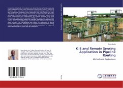
GIS and Remote Sensing Application in Pipeline Routing
Methods and Applications
Versandkostenfrei!
Versandfertig in 6-10 Tagen
41,99 €
inkl. MwSt.

PAYBACK Punkte
21 °P sammeln!
Conventional methods for optimal route determination which incorporates coarse scale paper maps, hand delineation methods and manual overlay of elevation layers have often been used in optimal routing activities for oil and gas pipelines. However, errors associated with coarse scale data, user subjectivity and manual overlays have led to considerations for alternative techniques. This book outlines a Geographical Information Systems (GIS) based methodology for determining an optimal pipeline route that incorporates Multi Criteria Evaluation (MCE) and Least Cost Path Analysis (LCPA). This metho...
Conventional methods for optimal route determination which incorporates coarse scale paper maps, hand delineation methods and manual overlay of elevation layers have often been used in optimal routing activities for oil and gas pipelines. However, errors associated with coarse scale data, user subjectivity and manual overlays have led to considerations for alternative techniques. This book outlines a Geographical Information Systems (GIS) based methodology for determining an optimal pipeline route that incorporates Multi Criteria Evaluation (MCE) and Least Cost Path Analysis (LCPA). This methodology allows for objective evaluation of different cost surface layers for weighting the constraints that determine the optimal route location. The methodology also allows for evaluation of several factors and constraints, allowing for an optimal route that meets among others; economic, environmental and security expectations or a general hybrid solution for the client and the community.


