- Gebundenes Buch
- Merkliste
- Auf die Merkliste
- Bewerten Bewerten
- Teilen
- Produkt teilen
- Produkterinnerung
- Produkterinnerung
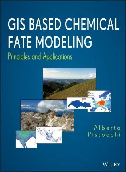
This book covers the integration of chemical fate modeling for use in Geographic Information System (GIS) functions. It features a practical and hands-on approach that's intended for modelers preparing maps of chemical emissions, and creating landscape and climate properties within a GIS, while chemical fate calculations are performed using specialized model codes. A relevant part of the book also discusses data retrieval and processing as a basis for modeling. As such, the book offers a one-stop reference for practitioners who wish to integrate GIS with chemical modeling.
Explains how GIS…mehr
Andere Kunden interessierten sich auch für
- Jonathan D. RaffElements of Environmental Chemistry90,99 €
- Jeffrey S. GaffneyChemistry of Environmental Systems112,99 €
- George W. LutherInorganic Chemistry for Geochemistry and Environmental Sciences111,99 €
- Transformation Products of Emerging Contaminants in the Environment462,99 €
- Forbes R. McDougallIntegrated Solid Waste Mgt367,99 €
- John H. SeinfeldAtmospheric Chemistry and Physics163,99 €
- Ramesha ChandrappaSustainable Water Engineering164,99 €
-
-
-
This book covers the integration of chemical fate modeling for use in Geographic Information System (GIS) functions. It features a practical and hands-on approach that's intended for modelers preparing maps of chemical emissions, and creating landscape and climate properties within a GIS, while chemical fate calculations are performed using specialized model codes. A relevant part of the book also discusses data retrieval and processing as a basis for modeling. As such, the book offers a one-stop reference for practitioners who wish to integrate GIS with chemical modeling.
Explains how GIS enhances the development of chemical fate and transport models
Over the past decade, researchers have discovered that geographic information systems (GIS) are not only excellent tools for managing and displaying maps, but also useful in the analysis of chemical fate and transport in the environment. Among its many benefits, GIS facilitates the identification of critical factors that drive chemical fate and transport. Moreover, GIS makes it easier to communicate and explain key model assumptions.
Based on the author's firsthand experience in environmental assessment, GIS Based Chemical Fate Modeling explores both GIS and chemical fate and transport modeling fundamentals, creating an interface between the two domains. It then explains how GIS analytical functions enable scientists to develop simple, yet comprehensive spatially explicit chemical fate and transport models that support real-world applications. In addition, the book features:
Practical examples of GIS based model calculations that serve as templates for the development of new applications
Exercises enabling readers to create their own GIS based models
Accompanying website featuring downloadable datasets used in the book's examples and exercises
References to the literature, websites, data repositories, and online reports to facilitate further research
Coverage of important topics such as spatial decision support systems and multi-criteria analysis as well as ecological and human health risk assessment in a spatial context
GIS Based Chemical Fate Modeling makes a unique contribution to the environmental sciences by explaining how GIS analytical functions enhance the development and interpretation of chemical fate and transport models. Environmental scientists should turn to this book to gain a deeper understanding of the role of GIS in describing what happens to chemicals when they are released into the environment.
Hinweis: Dieser Artikel kann nur an eine deutsche Lieferadresse ausgeliefert werden.
Explains how GIS enhances the development of chemical fate and transport models
Over the past decade, researchers have discovered that geographic information systems (GIS) are not only excellent tools for managing and displaying maps, but also useful in the analysis of chemical fate and transport in the environment. Among its many benefits, GIS facilitates the identification of critical factors that drive chemical fate and transport. Moreover, GIS makes it easier to communicate and explain key model assumptions.
Based on the author's firsthand experience in environmental assessment, GIS Based Chemical Fate Modeling explores both GIS and chemical fate and transport modeling fundamentals, creating an interface between the two domains. It then explains how GIS analytical functions enable scientists to develop simple, yet comprehensive spatially explicit chemical fate and transport models that support real-world applications. In addition, the book features:
Practical examples of GIS based model calculations that serve as templates for the development of new applications
Exercises enabling readers to create their own GIS based models
Accompanying website featuring downloadable datasets used in the book's examples and exercises
References to the literature, websites, data repositories, and online reports to facilitate further research
Coverage of important topics such as spatial decision support systems and multi-criteria analysis as well as ecological and human health risk assessment in a spatial context
GIS Based Chemical Fate Modeling makes a unique contribution to the environmental sciences by explaining how GIS analytical functions enhance the development and interpretation of chemical fate and transport models. Environmental scientists should turn to this book to gain a deeper understanding of the role of GIS in describing what happens to chemicals when they are released into the environment.
Hinweis: Dieser Artikel kann nur an eine deutsche Lieferadresse ausgeliefert werden.
Produktdetails
- Produktdetails
- Verlag: Wiley & Sons
- 1. Auflage
- Seitenzahl: 520
- Erscheinungstermin: April 2014
- Englisch
- Abmessung: 287mm x 220mm x 30mm
- Gewicht: 1630g
- ISBN-13: 9781118059975
- ISBN-10: 1118059972
- Artikelnr.: 36701710
- Herstellerkennzeichnung
- Libri GmbH
- Europaallee 1
- 36244 Bad Hersfeld
- 06621 890
ALBERTO PISTOCCHI, MSc Eng, MSc Phil, PhD, is Adjunct Professor of Spatial Decision Support Systems at the University of Trento, Italy, and the author of several scientific contributions to the fields of hydrology, environmental assessment, chemical fate and transport modeling, and spatial decision support systems. As a researcher, environmental analyst, and project manager, he has been working for the European Commission's Joint Research Centre, the Emilia Romagna regional government, and other private and public organizations. He is a founding partner (2001) and the scientific director of GECOsistema, a research spin-off from the University of Bologna, Italy.
Preface xiii
Contributors xvii
Chapter 1 Chemicals, Models, and GIS: Introduction 1
1-1 Chemistry, Modeling, and Geography 1
1-2 Mr. Palomar and Models 2
1-3 What Makes a Model Different? 4
1-4 Simple, Complex, or Tiered? 7
Compatibility of Emissions and Concentrations 9
Spatiotemporal Variability 10
Spatial Patterns 12
More Complex Models and the Tale of Horatii and Curiatii 15
1-5 For Whom is this Book Written? 17
References 19
Chapter 2 Basics of Chemical Compartment Models and Their Implementation
with GIS Functions 23
2-1 Introduction 23
2-2 Phase Partitioning 24
Air Compartment 24
Surface Water Compartment 25
Soil Compartment 25
2-3 Diffusion, Dispersion, and Advection 26
2-4 Fluxes at the Interfaces 28
Air-Ground Surface Interface 28
Water-Air and Water-Bottom Sediment Interface 28
Soil-Air and Soil-Water Interface 29
Parameterization of Advection Velocities and Diffusion/Dispersion Rates 29
2-5 Reactions 32
2-6 Transport Within an Environmental Medium: The Advection-Diffusion
Equation (ADE) 33
Soils 37
Surface Water 38
Atmosphere 39
2-7 Analytical Solutions 40
Example: The Domenico Model 40
Example: Implementation of a River Plug Flow Model in a Spreadsheet 45
2-8 Box Models, Multimedia and Multispecies Fate and Transport 47
Example: Implementing a Box Model of Soil Contamination and Water Pollution
Loading in a Spreadsheet 51
2-9 Spatial Models: Implicit, Explicit, Detailed Explicit, and GIS-Based
Schemes 57
References 65
Chapter 3 Basics of GIS Operations 71
3-1 What is GIS? 71
3-2 GIS Data 72
Coordinate Systems 72
Example: Coordinate Transformation 75
Example: Georeference a Map from a Paper Using ArcGIS 77
GIS Formats 81
3-3 GIS Software 92
3-4 GIS Standards 93
Exercise: Browse and Export Geographic Objects in KML and Combine Them with
Layers from a WMS 94
3-5 A Classification of GIS Operations for Chemical Fate Modeling 99
3-6 Spatial Thinking 100
3-7 Beyond GIS 103
3-8 Further Progress on GIS 104
References 104
Chapter 4 Map Algebra 107
4-1 Map Algebra Operators and Syntaxes 109
4-2 Using Map Algebra to Compute a Gaussian Plume 112
Example: Using Map Algebra to Compute Volatilization Rates from Water
Bodies 119
4-3 Using Map Algebra to Implement Isolated Box Models 121
References 124
Chapter 5 Distance Calculations 127
5-1 Concepts of Distance Calculations 127
Example: Feature Buffering 127
Example: Join Based on Distance 129
5-2 Distance Along a Surface and Vertical Distance 134
5-3 Applications of Euclidean Distance in Pollution Problems 135
5-4 Cost Distance 139
Exercise: Euclidean and Cost distance Calculations 140
References 148
Chapter 6 Spatial Statistics and Neighborhood Modeling in GIS 149
6-1 Variograms: Analyzing Spatial Patterns 149
Exercise: Computing Variograms of Observed Atmospheric Contaminants 154
6-2 Interpolation 160
6-3 Zonal Statistics 163
6-4 Neighborhood Statistics and Filters 164
Exercise: Creating a Population Map from Point and Polygon Data 169
References 170
Chapter 7 Digital Elevation Models, Topographic Controls, and Hydrologic
Modeling in GIS 171
7-1 Basic Surface Analysis 171
7-2 Drainage 178
Example: Pit Filling, Flow Direction, Flow Accumulation, and Flow Length in
ArcGIS 178
Example: Catchment Population in India 183
Example: Travel Time 185
7-3 Using GIS Hydrological Functions in Chemical Fate and Transport
Modeling 187
7-4 Non-D8 Methods and the TauDEM Algorithms 190
7-5 ESRI's ''Darcy Flow'' and ''Porous Puff'' Functions 191
References 193
Chapter 8 Elements of Dynamic Modeling in GIS 195
8-1 Dynamic GIS Models 195
8-2 Studying Time-Dependent Effects With Simple Map Algebra 200
Intermittent Emissions 200
Lagged Release from Historical Stockpiles 201
Stepwise Constant Emission and Removal Processes 202
8-3 Decoupling Spatial and Temporal Aspects of Models: The Mappe Global
Approach 203
References 206
Chapter 9 Metamodeling and Source-Receptor Relationship Modeling in GIS
209
9-1 Introduction 209
9-2 Metamodeling 210
9-3 Source-Receptor Relationships 213
References 215
Chapter 10 Spatial Data Management in GIS and the Coupling of GIS and
Environmental Models 217
10-1 Introduction 217
10-2 Historical Perspective of Emergence of Spatial Databases in
Environmental Domain 218
10-3 Spatial Data Management in GIS: Theory and History 221
Spatial Database Definition 221
Relational Data Model Foundations 221
Object Relational Concepts: A Foundation Model for Spatial
Databases-Theoretical Background 224
PostgreSQL/PostGIS Object Relational Support 225
Oracle Object Relational Support 225
10-4 Spatial Database Solutions 226
ESRI Geodatabase 226
PostgreSQL and PostGIS 229
Oracle Locator and Spatial 230
10-5 Simple Environmental Spatiotemporal Database Skeleton and GIS:
Hands-On Examples 230
Simple PostgreSQL/PostGIS Environmental Spatiotemporal Database Skeleton
and QuantumGIS 231
Simple Oracle XE Environmental Spatiotemporal Database Skeleton 237
10-6 Generalized Environmental Spatiotemporal Database Skeleton and
Geographic Mashups 244
Spatiotemporal Database Skeleton 244
Geographic Mashup 246
References 249
Chapter 11 Soft Computing Methods for the Overlaying of Chemical Data
with Other Spatially Varying Parameters 253
11-1 Introduction 253
11-2 Fuzzy Logic and Expert Judgment 258
11-3 Spatial Multicriteria Analysis 262
11-4 An Example of Vulnerability Mapping of Water
Resources to Pollution 266
References 276
Chapter 12 Types of Data Required for Chemical Fate Modeling 279
12-1 Climate and Atmospheric Data 280
12-2 Soil Data 286
12-3 Impervious Surface Area 289
12-4 Vegetation 289
12-5 Hydrological Data 291
12-6 Elevation Data 293
12-7 Hydrography 296
12-8 Lakes 298
12-9 Stream Network Hydraulic Data 298
12-10 Ocean Parameters 299
12-11 Human Activity 301
Land Use/Land Cover 303
Population 305
Stable Lights at Night 306
12-12 Using Satellite Images for the Extraction of Environmental Parameters
306
12-13 Compilations of Data for Chemical Fate and Transport Modeling 307
References 307
Chapter 13 Retrieval and Analysis of Emission Data 311
13-1 Characterization of Emissions 311
13-2 Emissions based on Production Volumes 312
13-3 Estimation from Usage or Release Inventories 313
13-4 Emission Factors 313
13-5 Spatial and Temporal Distribution of Emissions 314
Diffuse Emissions at Local to Regional Scale 317
Example: Estimating Urban Runoff Contaminants from Land Use and Population
Data in the Province
of Naples, Italy 318
Exercise: Apportionment of Emissions Using a Geographic Pattern 318
13-6 Modeling Traffic Flows 322
References 326
Chapter 14 Characterization of Environmental Properties and Processes 329
14-1 Physicochemical Properties and Partition Coefficients 329
14-2 Aerosol and Suspended Sediments 330
Exercise: Computing SPM in Rivers Using the Formula of Hakanson and
Co-workers 332
14-3 Diffusive Processes 335
14-4 Dispersion 335
14-5 Advective Processes 336
Atmospheric Deposition 336
Soil Water Budget Calculations 338
Soil Erosion 344
14-6 River and Lake Hydraulic Geometry 344
References 350
Chapter 15 Complex Models, GIS, and Data Assimilation 353
15-1 Atmospheric Transport Models 353
Example: Dispersion Modeling of an Atmospheric Emission in Australia 354
15-2 Transport in Groundwater and the Analytic Element Method 361
15-3 GIS Functions of Modeling Systems and Data Assimilation 361
References 363
Chapter 16 The Issue of Monitoring Data and the Evaluation of Spatial
Models of Chemical Fate 365
16-1 Existing Monitoring Programs 366
16-2 Distributed Sampling 366
16-3 Methods for the Comparison of Measured and Modeled Concentrations 367
Exercise: Comparison of Two PCB Soil Concentration Models 368
References 375
Chapter 17 From Fate to Exposure and Risk Modeling with GIS 377
17-1 Exposure and Risk for Human Health 377
17-2 Models for the Quantification of Chemical Intake by Humans 382
Exercise: Human Exposure, Intake, and Cancer Risk Related to Ingestion of
Aboveground Produce
Contaminated by Gas and Dust Deposition of 2,3,7,8-TCDD Emitted from an
Industrial Emission Source 386
17-3 Ecological and Environmental Risk Assessment 393
Exercise: Mapping Patch Area and Ecotones in South America 398
17-4 Data for GIS Based Risk Assessment 400
References 401
Chapter 18 GIS Based Models in Practice: The Multimedia Assessment of
Pollutant Pathways in the Environment (MAPPE) Model 405
18-1 Introduction 405
18-2 Environmental Compartments Considered in the Model 407
Atmosphere Compartment 409
Soil Compartment 412
Inland Water Compartment 413
Seawater 415
18-3 Implementation in GIS: Example with Lindane 416
Scalar Input Quantities 416
Maps Describing Landscape and Climate Parameters 418
Air Compartment Calculations 419
Soil Compartment Calculations 422
Inland Water Compartment Calculations 427
Seawater Compartment Calculations 434
18-4 Using the Model For Scenario Assessment 436
References 441
Chapter 19 Inverse Modeling and Its Application to Water Contaminants 443
19-1 Introduction 443
Exercise: Inverse Modeling of Caffeine in Europe 447
References 451
Chapter 20 Chemical Fate and Transport Indicators and the Modeling of
Contamination Patterns 453
20-1 The Relative Risk Model 453
Example: Relative Risk Assessment for Coastal Ecosystems Due to Wastewater
Emission in South Africa 456
20-2 Use of Chemical Fate and Transport Indicators in the Context of
Relative Risk Assessment:
An Example with Contaminants Applied to Soil 459
Example: Generic Modeling of Sewage Sludge Soil Application in Mexico 464
References 472
Chapter 21 Perspectives: The Challenge of Cumulative Impacts and
Planetary Boundaries 475
References 478
Index 481