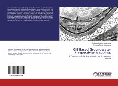
GIS-Based Groundwater Prospectivity Mapping:
A Case study of the Sokoto Basin, north - western Nigeria
Versandkostenfrei!
Versandfertig in 6-10 Tagen
24,99 €
inkl. MwSt.

PAYBACK Punkte
12 °P sammeln!
Advancement in space technology today has made it possible to explore reliable techniques of groundwater exploration at low cost other than the more cumbersome conventional field methods. Integration of Geographical Information System (GIS) with remotely sensed data using the analytical hierarchy procedure (AHP), has provided the means of judgement consistency and simplifies preference rating amidst decision criteria of the various factors that control groundwater occurrence. Hence, groundwater prospectivity zones can be delineated. The prospect zones aids water agencies and managers to design...
Advancement in space technology today has made it possible to explore reliable techniques of groundwater exploration at low cost other than the more cumbersome conventional field methods. Integration of Geographical Information System (GIS) with remotely sensed data using the analytical hierarchy procedure (AHP), has provided the means of judgement consistency and simplifies preference rating amidst decision criteria of the various factors that control groundwater occurrence. Hence, groundwater prospectivity zones can be delineated. The prospect zones aids water agencies and managers to design an effective water resources management strategy on a regional basis more faster and at less cost.


