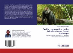
According to IUCN, the Cross River Gorilla (Gorilla gorilla diehli) is a critically endangered species. This primate occurs only in the forested region straddling the border between Cameroon and Nigeria. Recently, a sub-population has been discovered in the Lebialem-Mone Forest landscape (LMFL) of Western Cameroon. The gorillas at the LMFL are found in a non-permanent forest estate meaning that this area can be converted into any form of land use other than forestry. Fauna and Flora International and the Environment and Rural Development Foundation are working towards designating a wildlife sanctuary for this gorilla and other biodiversity but in order to proceed, knowledge about the changes that have occurred in the area over the past years, an up-to date situation of the landscape as well as the current and emerging challenges of protecting the habitat is very necessary. Since satellite images can be consistent through time and provide a synoptic view of spatial land cover, they have become important tools for conservation. It is for this reason that the present study employed Landsat and SPOT images of 1986 and 2011 respectively, coupled with fieldwork to assess the changes.
Bitte wählen Sie Ihr Anliegen aus.
Rechnungen
Retourenschein anfordern
Bestellstatus
Storno

