Recent developments in Science and Technology have removed the boundaries betwe~n the so-called 'fundamental' and 'applied' fields of research. This has been particularly evident in the rapidly expanding geophysical sciences with their far reaching applications. Fundamental geophysical studies of surface, subsurface and crustal structures where gravity investigations play an important role, are of immediate potential importance in defining major structural features or geological units which may control or influence the development of metallogenic provinces, petroleum potential areas or coal…mehr
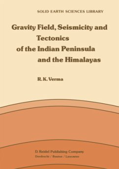
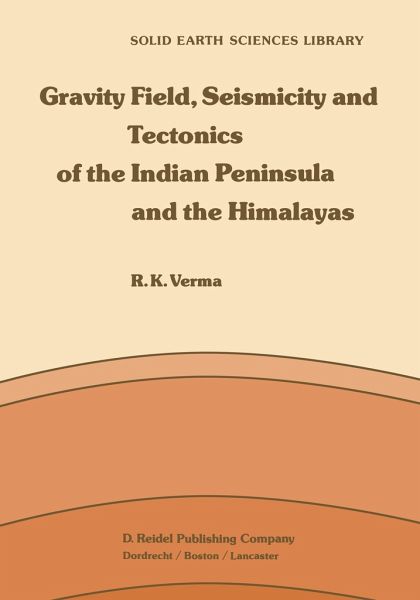
Recent developments in Science and Technology have removed the boundaries betwe~n the so-called 'fundamental' and 'applied' fields of research. This has been particularly evident in the rapidly expanding geophysical sciences with their far reaching applications. Fundamental geophysical studies of surface, subsurface and crustal structures where gravity investigations play an important role, are of immediate potential importance in defining major structural features or geological units which may control or influence the development of metallogenic provinces, petroleum potential areas or coal fields. Gravity studies in India have a long history and tradition. The earliest gravity measurements were made with two brass pendulums loaned by the Royal Society of England, when Basevi and Heaviside established 30 gravity pendulum stations between Cape Comorin and Ladakh during 1865 to 1873. Over the subsequent years, large areas of the country have been systematically covered through gravimeters and a number of regional and detailed studies have been undertaken by various agencies like Survey of India, Geological Survey of India (GSI), Oil and Natural Gas Commission (ONGC), National Geophysical Research Institute (NGRI) and a number of universities. Assistance was provided by late Prof. G. P. Woollard and his former students Muckenfuss, Bonini, Shankaranarayan and Murali Manghnani, who have connected India to the international gravity net work. Gravity studies carried out by the Survey of India have been of great value in geodetic studies.Hinweis: Dieser Artikel kann nur an eine deutsche Lieferadresse ausgeliefert werden.
1. Measurement of Gravity for Study of Figure of the Earth.- 1.1. Basic Concepts.- 1.2. Reduction of Gravity Data.- 1.3. General Remarks.- 2. Geology and Tectonics of Indian Peninsula.- 2.1. Introduction.- 2.2. Precambrians of Southern Peninsula.- 2.3. Eastern Ghats.- 2.4. Cuddapah Basin.- 2.5. Singhbhum in Bihar and Orissa.- 2.6. Satpura Orogenic Belt.- 2.7. Aravallis and Vindhyans.- 2.8. Precambrian of Madhya Pradesh.- 2.9. Gondwanas of Peninsular India.- 2.10. Earth Movements During Cretaceous and Eocene Times.- 2.11. Deccan Lavas.- 2.12. Formation of Indo-Gangetic Basin.- 2.13. Mountain Ranges and Plateaus of Peninsular India.- 3. Description of Bouguer and Free-Air Anomaly Maps of Peninsular India.- 3.1. Bouguer Anomaly Map.- 3.2. Major Trends on Bouguer Anomaly Map.- 3.3. Free-air Anomalies in Peninsular India.- 3.4. Inter-Relationship of Various Anomalies.- 4. Gravity Field and Tectonics of Gondwana Basins of Peninsular India.- 4.1. Introduction.- 4.2. Gravity Anomalies and Gondwana Tectonics.- 4.3. Geology of Gondwana Basins - General Remarks.- 4.4. Density of Gondwana Sediments.- 4.5. Godavari and Narmada - Son Valleys.- 4.6. Mahanadi Valley.- 4.7. Damodar Valley Coalfields.- 5. Gravity Field and its Relationship to Structures in Dharwar and Bastar Provinces of India.- 5.1. Introduction.- 5.2. Physiography.- 5.3. Geology of Dharwar Province.- 5.4. Gravity Field of Dharwar.- 5.5. Geological Implications of the Models.- 5.6. Gravity Field over Bastar Province.- 5.7. Nature of Upper Crust in the Archaean Terrain of South India.- 6. Gravity Field in the Eastern Ghats Belt.- 6.1. Geology of the Area.- 6.2. Gravity Field over Southern Granulite Terrain.- 6.3. Gravity Field over the Coastal Granulite Terrain.- 6.4. Nature of the Boundary Between Eastern Ghats andDharwar/Bastar Provinces.- 7. Analysis of Gravity Field Over Singhbhum and Adjoining Areas.- 7.1 Introduction.- 7.2. Geology of the Area.- 7.3. Observed Bouguer Anomaly Map.- 7.4. Interpretation of Major Anomalies in Terms of Two/Three Dimensional Models.- 7.5. Significance of Results in Terms of Geologic History of Singhbhum.- 8. Isostasy in Indian Peninsula.- 8.1. Historical Development of Isostasy in India.- 8.2. Various Schemes of Isostatic Compensation.- 8.3. Method of Computing Isostatic Anomaly.- 8.4. Isostatic Anomaly Map of Peninsular India.- 8.5. Depth of Compensation.- 9. Gravity Field and Isostasy in the Himalayas.- 9.1. Geology and Tectonics of the Himalaya.- 9.2. Geodetic Evidence for Prevalence of Isostasy.- 9.3. Gravity Field in the Himalaya.- 9.4. Gravity Traverses Across the Himalaya.- 9.5. Analysis of Results.- 9.6. Models for Isostatic Compensation.- 9.7. DSS Profile Across NW Himalaya.- 10. Satellite Gravity Field Over India and the Surrounding Regions.- 10.1. Introduction.- 10.2. Theoretical Background.- 10.3. Geoid Over India and the Surrounding Regions.- 10.4. Free-air Anomaly over India and the Surrounding Regions.- 10.5. General Remarks.- 11. Gravity Field and Seismicity in Northeastern India and Northern Burma.- 11.1. Introduction.- 11.2. Regional Geology and Tectonics.- 11.3. Bouguer Anomaly Map of Northeastern India.- 11.4. Pratt-Hayford Isostatic Anomaly Map of Northeastern India.- 11.5. Seismicity of NE India and N. Burma.- 11.6. Relationship Between Seismicity and Gravity Field in NE India and N. Burma.- 11.7. Plate Tectonics Model for Northeast India and N. Burma.- 12. Seismicity of the Himalayas and Plate Tectonics.- 12.1. Introduction.- 12.2. Geology and Tectonics of the Himalayas.- 12.3. Seismicity and its Relationship to Faults.- 12.4. Quantitative Seismicity.- 12.5. Focal Mechanism Solutions for the Himalayas.- 12.6. Orientation of P Axes.- 12.7. Models for the Evolution of the Himalayas.- Author Index.
Es gelten unsere Allgemeinen Geschäftsbedingungen: www.buecher.de/agb
Impressum
www.buecher.de ist ein Shop der buecher.de GmbH & Co. KG i.I. Bürgermeister-Wegele-Str. 12, 86167 Augsburg Amtsgericht Augsburg HRA 13309