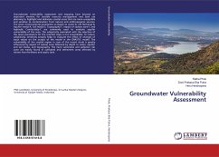
Groundwater Vulnerability Assessment
Versandkostenfrei!
Versandfertig in 6-10 Tagen
47,99 €
inkl. MwSt.

PAYBACK Punkte
24 °P sammeln!
Groundwater vulnerability assessment and mapping have become an important element for sensible resource management and land use planning to highlight and delineate coastal areas that are more susceptible and sensitive to contamination from natural and anthropogenic sources. The seven environmental parameters as Depth to water-D, net Recharge-R, Aquifer media-A, Soil media-S, Topography-T, Impact of vadose zone-I, and hydraulic Conductivity-C are commonly used to evaluate aquifer vulnerability of the area. The subjectivity associated with the selection of the seven parameters for the resulted m...
Groundwater vulnerability assessment and mapping have become an important element for sensible resource management and land use planning to highlight and delineate coastal areas that are more susceptible and sensitive to contamination from natural and anthropogenic sources. The seven environmental parameters as Depth to water-D, net Recharge-R, Aquifer media-A, Soil media-S, Topography-T, Impact of vadose zone-I, and hydraulic Conductivity-C are commonly used to evaluate aquifer vulnerability of the area. The subjectivity associated with the selection of the seven parameters for the resulted maps is not unavoidable. To reduce subjectivity, sensitivity analysis helps to evaluate the effect of changes of input values on the output of the model in the DRASTIC model. The vulnerability of the coastal region in case of the recent study is greatly influenced by impact of vadose zone followed by depth to water, aquifer and soil media, and topography. The more vulnerable and pollution risk zone are mainly found in cultivated and settlement areas affected by nitrate from fertilizers and septic tank.


