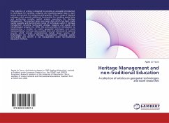
Heritage Management and non-traditional Education
A collection of articles on geospatial technologies and novel researches
Versandkostenfrei!
Versandfertig in 6-10 Tagen
27,99 €
inkl. MwSt.

PAYBACK Punkte
14 °P sammeln!
This collection of articles is designed to provide an accessible introduction to techniques for handling, analysing and visualising spatial data in open source environment for computing and graphics. It has a range of bespoke packages which provide additional functionality for handling spatial data and performing complex spatial analysis operations for Heritage Management. The practical series uses open data which has been made readily available and demonstrates range of techniques useful in heritage management including multivariate analysis, mapping and spatial and morphological analysis, et...
This collection of articles is designed to provide an accessible introduction to techniques for handling, analysing and visualising spatial data in open source environment for computing and graphics. It has a range of bespoke packages which provide additional functionality for handling spatial data and performing complex spatial analysis operations for Heritage Management. The practical series uses open data which has been made readily available and demonstrates range of techniques useful in heritage management including multivariate analysis, mapping and spatial and morphological analysis, etc. While this series provides an introduction to implementing a number of useful geospatial techniques and novel implementations, we have also provided links and references to external sources which provide comprehensive details about science and technologies for Cultural Heritage Management (including seismic vulnerability and retrofit in risk management) under non-traditional education methods.


