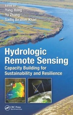
Hydrologic Remote Sensing
Capacity Building for Sustainability and Resilience
Herausgeber: Hong, Yang; Khan, Sadiq; Zhang, Yu
Hydrologic Remote Sensing
Capacity Building for Sustainability and Resilience
Herausgeber: Hong, Yang; Khan, Sadiq; Zhang, Yu
- Gebundenes Buch
- Merkliste
- Auf die Merkliste
- Bewerten Bewerten
- Teilen
- Produkt teilen
- Produkterinnerung
- Produkterinnerung
Environmental remote sensing plays a critical role in observing key hydrological components such as precipitation, soil moisture, evapotranspiration and total water storage on a global scale. As water security is one of the most critical issues in the world, satellite remote sensing techniques are of particular importance for emerging regions which have inadequate in-situ gauge observations. This book reviews multiple remote sensing observations, the application of remote sensing in hydrological modeling, data assimilation and hydrological capacity building in emerging regions.
Andere Kunden interessierten sich auch für
![Remote Sensing and Digital Image Processing with R Remote Sensing and Digital Image Processing with R]() Marcelo de Carvalho Alves (Brazil Federal University of Lavras)Remote Sensing and Digital Image Processing with R156,99 €
Marcelo de Carvalho Alves (Brazil Federal University of Lavras)Remote Sensing and Digital Image Processing with R156,99 €![Fundamentals of Satellite Remote Sensing Fundamentals of Satellite Remote Sensing]() Emilio Chuvieco (Universidad de Alcala, Alcala de Henares, Spain)Fundamentals of Satellite Remote Sensing157,99 €
Emilio Chuvieco (Universidad de Alcala, Alcala de Henares, Spain)Fundamentals of Satellite Remote Sensing157,99 €![Fundamentals of Satellite Remote Sensing Fundamentals of Satellite Remote Sensing]() Emilio Chuvieco (Universidad de Alcala, Alcala de Henares, Spain)Fundamentals of Satellite Remote Sensing71,99 €
Emilio Chuvieco (Universidad de Alcala, Alcala de Henares, Spain)Fundamentals of Satellite Remote Sensing71,99 €![Hyperspectral Remote Sensing Hyperspectral Remote Sensing]() Marcus BorengasserHyperspectral Remote Sensing79,99 €
Marcus BorengasserHyperspectral Remote Sensing79,99 €![LiDAR Remote Sensing and Applications LiDAR Remote Sensing and Applications]() Pinliang Dong (University of North Texas, Denton, USA)LiDAR Remote Sensing and Applications127,99 €
Pinliang Dong (University of North Texas, Denton, USA)LiDAR Remote Sensing and Applications127,99 €![Re-Envisioning Remote Sensing Applications Re-Envisioning Remote Sensing Applications]() Re-Envisioning Remote Sensing Applications98,99 €
Re-Envisioning Remote Sensing Applications98,99 €![Multi-Sensor and Multi-Temporal Remote Sensing Multi-Sensor and Multi-Temporal Remote Sensing]() Anil Kumar (INDIA Indian Institute of Remote Sensing)Multi-Sensor and Multi-Temporal Remote Sensing96,99 €
Anil Kumar (INDIA Indian Institute of Remote Sensing)Multi-Sensor and Multi-Temporal Remote Sensing96,99 €-
-
-
Environmental remote sensing plays a critical role in observing key hydrological components such as precipitation, soil moisture, evapotranspiration and total water storage on a global scale. As water security is one of the most critical issues in the world, satellite remote sensing techniques are of particular importance for emerging regions which have inadequate in-situ gauge observations. This book reviews multiple remote sensing observations, the application of remote sensing in hydrological modeling, data assimilation and hydrological capacity building in emerging regions.
Produktdetails
- Produktdetails
- Verlag: Taylor & Francis Inc
- Seitenzahl: 395
- Erscheinungstermin: 5. Oktober 2016
- Englisch
- Abmessung: 241mm x 163mm x 23mm
- Gewicht: 922g
- ISBN-13: 9781498726665
- ISBN-10: 1498726666
- Artikelnr.: 46164924
- Herstellerkennzeichnung
- Libri GmbH
- Europaallee 1
- 36244 Bad Hersfeld
- gpsr@libri.de
Yang Hong is a professor of hydrometeorology and remote sensing in the School of Civil Engineering and adjunct professor in the School of Meteorology, University of Oklahoma. Currently, he also serves as honorary chair professor at Tsinghua University, Beijing, China. Previously, he was a research scientist at NASA's Goddard Space Flight Center and a postdoctoral researcher at University of California, Irvine. Dr. Hong currently directs the HyDROS Lab (http: //hydro.ou.edu) at the National Weather Center and also serves as the codirector of WaTER (Water Technology for Emerging Regions) Center. He is a faculty member of the Advanced Radar Research Center and is also an affiliated member of the Center for Analysis and Prediction of Storms at the University of Oklahoma. His areas of research span the wide range of hydrology-meteorology-climatology, with a particular interest in bridging the gap among water-weather-climate-human systems across scales in space and time. He has developed and taught subjects such as remote sensing retrieval and applications, advanced hydrologic modeling, climate change and natural hazards, engineering survey/measurement and statistics, land surface modeling, and data assimilation systems for hydrologic cycle and water systems under a changing climate. Dr. Hong has served on several international and national committees, review panels, and editorial boards of several journals. He has served as chair of the AGU-Hydrology Section Technical Committee on Precipitation (2008-2012) and has been an editor of numerous journals. He is a two-time recipient of the NASA Group Achievement Award "For Significant Achievement in Systematically Promoting and Accelerating the Use of NASA Scientific Research Results for Societal Benefits" and "For Global Precipitation Measuring Mission Post-launch Performance" by the NASA Headquarter Administrator in 2008 and 2015, respectively. He also received the 2014 University Regents' Award for Superior Research "For Superior Accomplishments in Research and Creative Activity, and Professional and University Service." He has extensively published in journals of remote sensing, hydrology, meteorology, and hazards and has disseminated several technologies to universities, governmental agencies, and private companies. Dr. Hong earned a PhD major in hydrology and water resources with a PhD minor in remote sensing and spatial analysis at the University of Arizona (2003), an MS (1999) in environmental sciences, and a BS (1996) in geosciences at Peking (Beijing) University, China.
Satellite Remote Sensing Observations. Satellite Remote Sensing for Global
Precipitation Monitoring. Diurnal Variability of Precipitation in West
Africa Monsoon Region. ET Mapping Utilizing Remote Sensing Data. Soil
Moisture Estimation Using Active and Passive Remote Sensing Techniques.
Remote Sensing Streamflow Estimation via AMSR-E and TMI. Remote Sensing for
Surface and Ground Water Observation. Total Water Storage Observed by
GRACE. Modeling and Data Assimilation. The Coupled Routing and Excess
Storage (CREST) Distributed Hydrological Mode. AMMAS Land Surface Model
Intercomparison over West Africa. Multi-Sensor Imaging and Space-Ground
Cross-Validation for 2010 Flood along Indus River, Pakistan.
Hydroclimatology of Lake Victoria Region Using Hydrologic Model and
Satellite Remote Sensing Data. Microwave Satellite Data for Hydrologic
Modeling in an Ungauged Basin in Africa. Assimilating the Passive Microwave
Streamflow Signals for Improving the Hydrological Predictions in Okavango
River Basin, Africa. Statistical and Hydrologic Evaluation of Satellite
Precipitation Products for Mountainous Basin. Capacity Building. Real Time
Operation Hydrological Monitoring and Forecasting System for Local Decision
Makers. Satellite Remote Sensing Drought Monitoring and Predictions Over
the Globe. Capacity Building Efforts in Hydrological Modeling for Africa -
Workshops about CREST Mode. Capacity Building for Pakistan
Hydrometeorologic Hazards. Cloud-Based Cyber-Infrastructure for Disaster
Monitoring sand Mitigation Mobile Device Apps for Empowering Citizen
Scientists.

