Masanobu Shimada
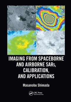
Imaging from Spaceborne and Airborne SARs, Calibration, and Applications
Masanobu Shimada
Imaging from Spaceborne and Airborne SARs, Calibration, and Applications
- Broschiertes Buch
- Merkliste
- Auf die Merkliste
- Bewerten Bewerten
- Teilen
- Produkt teilen
- Produkterinnerung
- Produkterinnerung
Synthetic Aperture Radar is a topic of great interest all over the world.
Andere Kunden interessierten sich auch für
![Fundamentals of Capturing and Processing Drone Imagery and Data Fundamentals of Capturing and Processing Drone Imagery and Data]() Fundamentals of Capturing and Processing Drone Imagery and Data66,99 €
Fundamentals of Capturing and Processing Drone Imagery and Data66,99 €![Hyperspectral Remote Sensing Hyperspectral Remote Sensing]() Marcus BorengasserHyperspectral Remote Sensing79,99 €
Marcus BorengasserHyperspectral Remote Sensing79,99 €![LiDAR Remote Sensing and Applications LiDAR Remote Sensing and Applications]() Pinliang Dong (University of North Texas, Denton, USA)LiDAR Remote Sensing and Applications127,99 €
Pinliang Dong (University of North Texas, Denton, USA)LiDAR Remote Sensing and Applications127,99 €![Remote Sensing and Digital Image Processing with R Remote Sensing and Digital Image Processing with R]() Marcelo de Carvalho Alves (Brazil Federal University of Lavras)Remote Sensing and Digital Image Processing with R156,99 €
Marcelo de Carvalho Alves (Brazil Federal University of Lavras)Remote Sensing and Digital Image Processing with R156,99 €![Image Analysis, Classification and Change Detection in Remote Sensing Image Analysis, Classification and Change Detection in Remote Sensing]() Morton John Canty (Germany Juelich Research Center)Image Analysis, Classification and Change Detection in Remote Sensing68,99 €
Morton John Canty (Germany Juelich Research Center)Image Analysis, Classification and Change Detection in Remote Sensing68,99 €![Multi-Sensor and Multi-Temporal Remote Sensing Multi-Sensor and Multi-Temporal Remote Sensing]() Anil Kumar (INDIA Indian Institute of Remote Sensing)Multi-Sensor and Multi-Temporal Remote Sensing96,99 €
Anil Kumar (INDIA Indian Institute of Remote Sensing)Multi-Sensor and Multi-Temporal Remote Sensing96,99 €![Multi-Sensor and Multi-Temporal Remote Sensing Multi-Sensor and Multi-Temporal Remote Sensing]() Anil Kumar (INDIA Indian Institute of Remote Sensing)Multi-Sensor and Multi-Temporal Remote Sensing66,99 €
Anil Kumar (INDIA Indian Institute of Remote Sensing)Multi-Sensor and Multi-Temporal Remote Sensing66,99 €-
-
-
Produktdetails
- Produktdetails
- SAR Remote Sensing
- Verlag: Taylor & Francis Ltd
- Seitenzahl: 392
- Erscheinungstermin: 30. Juni 2020
- Englisch
- Abmessung: 254mm x 178mm x 21mm
- Gewicht: 900g
- ISBN-13: 9780367570798
- ISBN-10: 0367570793
- Artikelnr.: 69188056
- Herstellerkennzeichnung
- Libri GmbH
- Europaallee 1
- 36244 Bad Hersfeld
- gpsr@libri.de
Masanobu Shimada (M'97-SM'04-F'11) received the BS and MS degrees in aeronautical engineering from Kyoto University in 1977 and 1979, and the PhD degree in electrical engineering from the University of Tokyo in 1999. He joined the National Space Development Agency of Japan (NASDA, former Japan Aerospace Exploration Agency (JAXA)) in 1979 and conducted the research projects for 34 years. During that, he made three achievements: 1) Sensor developments, i.e., Ku-band Scatterometer, Polarimetric Interferometric Airborne L-band SAR 1 and 2, 2) Operational Algorithm developments: SAR imaging, Interferometry, Polarimetry, Calibration, Mosaicking, and applications, 3) lead the science projects: the JERS-1 SAR calibration and validation (1992-1998), the JERS-1 Science project (Global rainforest and boreal forest mapping project and SAR interferometry for detecting the deformation distribution), the ALOS science project and PALSAR CALVAL, and the Kyoto and Carbon Initiative project using the time series PALSAR/PALSAR2 mosaics. His most impacted achievements are the deformation detection of the Hanshinn-Awaji-Earthquake using the JERS-1 SAR Interferometry, generation of world first global SAR mosaics that depicts the annual deforestation change, and experimental near real time deforestation monitoring using the ALOS/PALSAR ScanSAR. His current research interests are high resolution imaging for spaceborne and airborne SARs (PALSAR-2 and Pi-SAR-L2), calibration and validation, SAR applications including polarimetric SAR interferometry, and MTI using the UAVSAR interferometry. Since April 1 2015, He is a professor at Tokyo Denki University, an invited researcher of JAXA, and a guest professor of Yamaguchi University, and from 2018, a lecturer at the Nara Women University. At Tokyo Denki University, he brought up the graduation of the 18 students, on-going 6 master students.
1. Introduction 2. Introduction of the SAR System 3. SAR Imaging and
Analysis 4. Radar Equation for SAR Correlation Power-Radiometry 5. ScanSAR
Imaging 6. Polarimetric Calibration 7. SAR Elevation Antenna Pattern-Theory
and Measured Pattern from the Natural Target Data 8.
Geometry/Ortho-Rectification and Slope-Corrections 9.
Calibration-Radiometry and Geometry 10. Defocusing and Image Shift due to
the Moving Target 11. Mosaicking and Multi-Temporal SAR Imaging 12. SAR
Interferometry 13. Irregularities (RFI and Ionosphere) 14. Applications 15.
Forest Map Generation

