Impact of Land Use/Cover Change on Community Livelihood in Zanzibar
The Case of Masingini Forest Reserve
Versandkostenfrei!
Versandfertig in 6-10 Tagen
37,99 €
inkl. MwSt.

PAYBACK Punkte
19 °P sammeln!
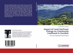
This study examined the impact of land use/cover change on community livelihoods around Masingini forest reserve, Zanzibar. It analysed the socio-economic drivers of land use/cover change as well as determining its nature and extent. A sample of 189 households were drawn from two shehias around the forest namely Dole and Mwanyanya. Spatial analysis of Aerial photographs for 1952 and 1977 and satellite imagery for 2009 was conducted. Household survey, group discussions, in-depth interview and observations were used to capture the socio-economic drivers. The findings showed an increase and decre...
This study examined the impact of land use/cover change on community livelihoods around Masingini forest reserve, Zanzibar. It analysed the socio-economic drivers of land use/cover change as well as determining its nature and extent. A sample of 189 households were drawn from two shehias around the forest namely Dole and Mwanyanya. Spatial analysis of Aerial photographs for 1952 and 1977 and satellite imagery for 2009 was conducted. Household survey, group discussions, in-depth interview and observations were used to capture the socio-economic drivers. The findings showed an increase and decrease of forest biomass. Between 1952-1977 lands under forests increased by 41% while between 1977-2009 it decreased by 36%. Furthermore, in the same period agricultural land increased from 7 to 12%, settlement from 0.9 to 27%, while degraded forest decreased from 3.2 to 2.5% and institution emerged at 0.1%. The study further shows that land use/cover change was caused by various socio-economic drivers.


