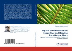
Impacts of Urbanization on Streamflow and Flooding from Natural Rivers
Impacts of Urbanization on Kaduna River Flooding and Stramflow Modelling
Versandkostenfrei!
Versandfertig in 6-10 Tagen
45,99 €
inkl. MwSt.

PAYBACK Punkte
23 °P sammeln!
This book examines the impacts of urbanization, particularly the Kaduna Urban Development, on flooding from the Kaduna River. The expansion of structural developments into traditional flood storage areas consequent to urbanization has modifies the channel shapes, reduces the width of the flood storage areas relative to bankfull width at every point along the river channel and modifies the flood flows containment characteristics of the channel. The Continuity equation in the St. Venant hydrodynamic equations was modified for the geomorphological parameter called the entrenchment ratio. The modi...
This book examines the impacts of urbanization, particularly the Kaduna Urban Development, on flooding from the Kaduna River. The expansion of structural developments into traditional flood storage areas consequent to urbanization has modifies the channel shapes, reduces the width of the flood storage areas relative to bankfull width at every point along the river channel and modifies the flood flows containment characteristics of the channel. The Continuity equation in the St. Venant hydrodynamic equations was modified for the geomorphological parameter called the entrenchment ratio. The modified model was applied to investigate the extent of inundation of the floodplain by floods of various frequencies. Results obtained indicated that the 2yr, 5yr, 10yr, 25yr, 50yr, and 100yr floods when occur can cause maximum inundation of between 82.53% to 94.48% of the floodplain area between the Eastern Byepass bridge and the Kaduna South Waterworks with Ungwan Rimi, Kabala Doki and Kigo road extension as the most critical areas.


