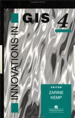
Innovations In GIS
Herausgeber: Kemp, Zarine
Innovations In GIS
Herausgeber: Kemp, Zarine
- Gebundenes Buch
- Merkliste
- Auf die Merkliste
- Bewerten Bewerten
- Teilen
- Produkt teilen
- Produkterinnerung
- Produkterinnerung
Derived from presentations made at the fourth annual UK National Conference on GIS Research, this work consists of contributions by leading experts in: geography, mathematics, computing science, surveying, archaeology, planning and medicine.
Andere Kunden interessierten sich auch für
![Innovations In GIS Innovations In GIS]() M. F. Worboys (ed.)Innovations In GIS287,99 €
M. F. Worboys (ed.)Innovations In GIS287,99 €![Innovations in Agriculture for a Self-Reliant India Innovations in Agriculture for a Self-Reliant India]() Innovations in Agriculture for a Self-Reliant India242,99 €
Innovations in Agriculture for a Self-Reliant India242,99 €![Green Innovations for Industrial Development and Business Sustainability Green Innovations for Industrial Development and Business Sustainability]() Green Innovations for Industrial Development and Business Sustainability115,99 €
Green Innovations for Industrial Development and Business Sustainability115,99 €![GIS for Environmental Decision-Making GIS for Environmental Decision-Making]() GIS for Environmental Decision-Making65,99 €
GIS for Environmental Decision-Making65,99 €![GIS for Group Decision Making GIS for Group Decision Making]() Piotr JankowskiGIS for Group Decision Making65,99 €
Piotr JankowskiGIS for Group Decision Making65,99 €![Innovations in Materials Manufacturing, Fabrication, and Environmental Safety Innovations in Materials Manufacturing, Fabrication, and Environmental Safety]() Mel SchwartzInnovations in Materials Manufacturing, Fabrication, and Environmental Safety281,99 €
Mel SchwartzInnovations in Materials Manufacturing, Fabrication, and Environmental Safety281,99 €![Innovations in Mining Backfill Technology Innovations in Mining Backfill Technology]() F.P. Hassani / M.J. Scoble / T.R. Yu (eds.)Innovations in Mining Backfill Technology130,99 €
F.P. Hassani / M.J. Scoble / T.R. Yu (eds.)Innovations in Mining Backfill Technology130,99 €-
-
-
Derived from presentations made at the fourth annual UK National Conference on GIS Research, this work consists of contributions by leading experts in: geography, mathematics, computing science, surveying, archaeology, planning and medicine.
Hinweis: Dieser Artikel kann nur an eine deutsche Lieferadresse ausgeliefert werden.
Hinweis: Dieser Artikel kann nur an eine deutsche Lieferadresse ausgeliefert werden.
Produktdetails
- Produktdetails
- Verlag: CRC Press
- Seitenzahl: 312
- Erscheinungstermin: 11. April 1997
- Englisch
- Abmessung: 260mm x 183mm x 21mm
- Gewicht: 785g
- ISBN-13: 9780748406562
- ISBN-10: 0748406565
- Artikelnr.: 25689300
- Herstellerkennzeichnung
- Libri GmbH
- Europaallee 1
- 36244 Bad Hersfeld
- gpsr@libri.de
- Verlag: CRC Press
- Seitenzahl: 312
- Erscheinungstermin: 11. April 1997
- Englisch
- Abmessung: 260mm x 183mm x 21mm
- Gewicht: 785g
- ISBN-13: 9780748406562
- ISBN-10: 0748406565
- Artikelnr.: 25689300
- Herstellerkennzeichnung
- Libri GmbH
- Europaallee 1
- 36244 Bad Hersfeld
- gpsr@libri.de
Zarine Kemp
Part 1 Data modelling and spatial data structures: a multiresolution data
storage scheme for 3D GIS, J. Mark Ware and Christopher Jones; storage
efficient techniques for digital, David Kidner and Derek Smith; modelling
historical change in Southern Corsica - temporal GIS development using an
extensible database system, Janet Bragg and Nick Ryan; toward a model for
multimedia Geographical Information Systems, Dean Lombardo and Zarine Kemp.
Part 2 Spatial analysis: recent advances in the exploratory analysis of
inter-regional flows in space and time, Duane Marble et al; a genetic
programming approach to building new spatial models relevant to GIS, Ian
Turton et al; exploring categorial spatial data - an interactive approach,
Chris Brunsdon; a universal translator of linguistic hedges for the
handling of uncertainty and fitness-for-use in Geographical Information
Systems, Allan Brimicombe; scripting and tool integration in spatial
analysis - prototyping local indicators and distance statistics, Roger
Bivand. Part 3 Environmental modelling: environmental modelling with
Geographic Information Systems, Peter Burrough; VGIS - a shell for the
conceptual design of environmental models, Jochen Albrecht et al; mapping
sub-pixel boundaries from remotely sensed images, Peter Atkinson; towards a
four-dimensional GIS - four-dimensional interpolation utilizing Kriging,
Eric Miller; assessing the influence of digital terrain model
characteristics in tropical slope stability analysis, Jim Hartshorne. Part
4 GIS - science, ethics and infrastructure: GIS without computers -
building geographic information science from the ground up, Helen
Couclelis; the ethics of six actors in the Geographical Information Systems
arena, Peter Fisher; geographic information - a resource, a commodity, an
asset or an infrastructure?, Robert Barr and Ian Masser. Part 5 GIS - the
impact of the Internet: designing a scientific database query server using
the World Wide Web - the example of tephrabase, Anthony Newton et al; open
spatial decision-making - evaluating the potential of the World Wide Web,
Steve Carver et al.


