121,99 €
inkl. MwSt.
Versandkostenfrei*
Versandfertig in über 4 Wochen
  • Broschiertes Buch

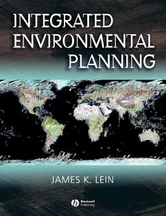
Integrated Environmental Planning presents a fresh, comprehensive approach to the diverse and dynamic world of environmental planning. In this accessible book, James Lein offers an essential guide to the mechanics of making a plan; introducing both the method and the tools necessary to environmental planning. Essential theoretical concepts are tied to understandable real-world examples. The latest planning technologies and methodologies, such as GIS and computer modeling, are integrated to offer the crucial "need to know" information for students and environmental professionals. Throughout,…mehr

Produktbeschreibung
Integrated Environmental Planning presents a fresh, comprehensive approach to the diverse and dynamic world of environmental planning. In this accessible book, James Lein offers an essential guide to the mechanics of making a plan; introducing both the method and the tools necessary to environmental planning. Essential theoretical concepts are tied to understandable real-world examples. The latest planning technologies and methodologies, such as GIS and computer modeling, are integrated to offer the crucial "need to know" information for students and environmental professionals. Throughout, Lein maintains a strong focus on the environmental principles that guide planning. In this clear and straightforward style, Lein closes the gap between theory and practice, technology and application, principle and plan. Through its scope and uniquely well-balanced content, Integrated Environmental Planning stands as an ideal introduction to environmental planning.
Hinweis: Dieser Artikel kann nur an eine deutsche Lieferadresse ausgeliefert werden.
Autorenporträt
James Lein is a professor of geography at Ohio University in Athens, Ohio. He serves as deputy director of OhioView and is a member of the executive board of directors of the AmericaView project. He specializes in the application of remote sensing and geographic information systems in environmental planning, risk assessment, and regional landscape analysis. His research interests focus on the monitoring of land-use/land-cover change, urban morphology and homeland defense, the integration of remote sensing and geographic information systems in regional planning and environmental impact assessment, and the incorporation of artificial intelligence methods to aid environmental decision making.