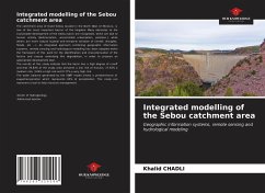
The catchment area of Oued Sebou located in the North West of Morocco, is one of the most important basins of the kingdom. Many obstacles to the sustainable development of the Sebou basin are recognized, which are due to human activity (deforestation, uncontrolled urbanization, pollution.), while others are more natural (spatial and temporal variation of rainfall, droughts, floods, etc ...). An integrated approach combining geographic information systems, remote sensing and hydrological modelling has been adopted within the framework of this work for the identification and characterisation of the factors and causes underlying this degradation, in order to propose an appropriate development plan.The results of this study indicate that the basin has a high degree of runoff and that 78.83% of the study area presents a low risk of erosion, 17.63% a medium risk, 3.04% a high risk and 0.77% a very high risk.The water balance generated by the SWAT model shows a predominance of evapotranspiration which represents 65% of precipitation. This study can represent a tool to help resource management.
Hinweis: Dieser Artikel kann nur an eine deutsche Lieferadresse ausgeliefert werden.
Hinweis: Dieser Artikel kann nur an eine deutsche Lieferadresse ausgeliefert werden.

