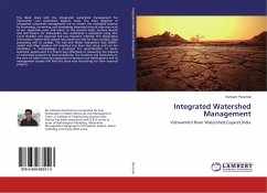
Integrated Watershed Management
Vishwamitri River Watershed,Gujarat,India
Versandkostenfrei!
Versandfertig in 6-10 Tagen
36,99 €
inkl. MwSt.

PAYBACK Punkte
18 °P sammeln!
This Book deals with the Integrated watershed management for Vishwamitri river watershed, Gujarat, India. The main objective of Integrated watershed management are to restore the ecological balance by harnessing, conserving and developing degraded natural resources such as soil, vegetative cover and water. In this present book, Surface Runoff and Soil Erosion for Vishwamitri river watershed is calculated using SCS-Curve Number and Universal Soil Loss Equation method. The Geographic Information System (GIS) played very important role for Data creation, data processing and its analysis. The Soil...
This Book deals with the Integrated watershed management for Vishwamitri river watershed, Gujarat, India. The main objective of Integrated watershed management are to restore the ecological balance by harnessing, conserving and developing degraded natural resources such as soil, vegetative cover and water. In this present book, Surface Runoff and Soil Erosion for Vishwamitri river watershed is calculated using SCS-Curve Number and Universal Soil Loss Equation method. The Geographic Information System (GIS) played very important role for Data creation, data processing and its analysis. The Soil and Water Assessment Tool (SWAT) model with Map window GIS interface has been also setup and run for simulation. A methodology is proposed for quantification of socio-economic aspects,and it is found very effectively in measuring the impacts of watershed program to local community. The students and researchers in the area of water resources,agriculture,irrigation,rural development and its management studies will find this book very interesting for their research projects.


