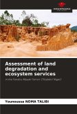
This study set out to assess the status and causes of land degradation in Sterkspruit, north-eastern South Africa, and the extent to which this had affected the biophysical environment and rural livelihoods. The research pursued a multidimensional approach, including detailed analysis of climatic data, development and analysis of land cover maps of Sterkspruit catchment, participatory rural appraisals and questionnaire surveys conducted in the villages of Magwiji and Hinana. Site-specific surveys involved generating degradation indices based on soil- and vegetation-related variables. Data were recorded for basal cover, species dominance, biomass productivity, and the presence of degradation indicator species. Soil loss estimates were made from measurements of gullies, rills, and pedestals, using related calculations. Laboratory analysis of soil samples checked for physical and chemical indicators. The study found degradation in the form of soil loss, increase in unpalatable grassspecies and bush encroachment. Residents cut back on arable agriculture and showed a trend towards the use of communal lands for residential purposes, while subsisting on government grants and pensions.
Bitte wählen Sie Ihr Anliegen aus.
Rechnungen
Retourenschein anfordern
Bestellstatus
Storno

