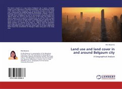
Land use and land cover in and around Belgaum city
A Geographical Analysis
Versandkostenfrei!
Versandfertig in 6-10 Tagen
32,99 €
inkl. MwSt.

PAYBACK Punkte
16 °P sammeln!
The book is based on a case study of Belgaum city. It gives a detailed insight on the importance of Stastical techniques, GIS and Remote Sensing in the field of Urban Geography. The surrounding boundary of the study unit is demarcated by applying Regional demarcation, Zone of influence, breaking point technique and 'Gravity Potential Model' of Reilly's. Land use and land cover of Belgaum city and its surrounding is being studied from 1970 to 2010. The Land use and Land cover of the study unit exhibit two distinct patterns one is specific or defined land use and the other is mixed land use. The...
The book is based on a case study of Belgaum city. It gives a detailed insight on the importance of Stastical techniques, GIS and Remote Sensing in the field of Urban Geography. The surrounding boundary of the study unit is demarcated by applying Regional demarcation, Zone of influence, breaking point technique and 'Gravity Potential Model' of Reilly's. Land use and land cover of Belgaum city and its surrounding is being studied from 1970 to 2010. The Land use and Land cover of the study unit exhibit two distinct patterns one is specific or defined land use and the other is mixed land use. The period of change analysis is divided into two epochs;the first epoch covers a period of thirty four years (1970-2004) while the second epoch concern to a period of Six years i.e., 2004 to 2010.The discussion shows that the amount of changes that have taken place in thirty four years (1970-2004) has taken place just within span of six years (2004-2010) which means the acceleration of changesis faster every year in the study area.


