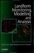
Geomorphologists played a major role in the 1960s and 1970s in terrain research as the potential of the computer was realised for both storing and manipulating landform information. With growth in the subject area, further technological development, and a growing input from other disciplines, much of this research has moved into the domain of GIS and Remote Sensing, where the involvement of geomorphologists has inevitably been reduced, despite the importance of this type of research to geomorphology in general. This book comprises selected and full-refereed papers from a recent BGRG Annual…mehr
Geomorphologists played a major role in the 1960s and 1970s in terrain research as the potential of the computer was realised for both storing and manipulating landform information. With growth in the subject area, further technological development, and a growing input from other disciplines, much of this research has moved into the domain of GIS and Remote Sensing, where the involvement of geomorphologists has inevitably been reduced, despite the importance of this type of research to geomorphology in general. This book comprises selected and full-refereed papers from a recent BGRG Annual Conference which was held with these issues in mind. The book contains both review and original and significant research papers that consider recent methodological developments in, and the constraints of, current terrain monitoring and modelling methods in geomorphology, along with the application of these methods to specific geomorphological problems. By providing up-to-date research by leaders in the field of terrain study this book will be of enormous value to undergraduates, research students and research scientists in geomorphology, mapping science and GIS and Remote Sensing, as well as those working in industry who use, or need to apply terrain research methods.Hinweis: Dieser Artikel kann nur an eine deutsche Lieferadresse ausgeliefert werden.
Stuart N. Lane is the author of Landform Monitoring, Modelling and Analysis , published by Wiley. Keith S. Richards is the author of Landform Monitoring, Modelling and Analysis, published by Wiley. Jim H. Chandler is the author of Landform Monitoring, Modelling and Analysis, published by Wiley.
Inhaltsangabe
Aus dem Inhalt: Introduction; Datums, Co-ordinates and Differences; GPS and Its Use for Terrain Modelling; Analytical Photogrammetry for Geomorphological Research; Quality, Use and Visualisation in Terrain Modelling; What Do Terrain Statistics Really Mean?; The Effect of Interpolation Errors on the Use of Datums in Geomorphology; A Review of the Potential for Landform and Lineament Identification Using Synthetic Aperture Radar; Image Analysis of Aerial Photography to Quantify the Effect of Gold Placer Mining on Channel Morphology; Terrain-Based Approaches to Environmental Resource Evaluation; The Role of GIS in Watershed Analysis; A Generalised Topographic-Soils Hydrological Index; Terrain Information in Geomorphological Models: Stability, Resolution and Sensitivity; The Application of Digital Terrain Models to Fluvial Geomorphology: A Review; Mass Balance and Flow Variations of the Haut Glacier d'Arolla, Switzerland, Calculated Using Digital Terrain Modelling Techniques; Modelling Glacier Melt and Transient Snowline Dynamics Using Satellite Imagery and A DEM; The Use of Terrain Analysis in the Evaluation of Snow Cover Over An Alpine Glacier; Coastal Management and Sea-Level Rise: A Morphological Approach; Analysis of Tidal Flows From A DTM of the Humber Estuary.
Es gelten unsere Allgemeinen Geschäftsbedingungen: www.buecher.de/agb
Impressum
www.buecher.de ist ein Internetauftritt der buecher.de internetstores GmbH
Geschäftsführung: Monica Sawhney | Roland Kölbl | Günter Hilger
Sitz der Gesellschaft: Batheyer Straße 115 - 117, 58099 Hagen
Postanschrift: Bürgermeister-Wegele-Str. 12, 86167 Augsburg
Amtsgericht Hagen HRB 13257
Steuernummer: 321/5800/1497
USt-IdNr: DE450055826