26,99 €
inkl. MwSt.
Versandkostenfrei*
Versandfertig in über 4 Wochen
  • Gebundenes Buch

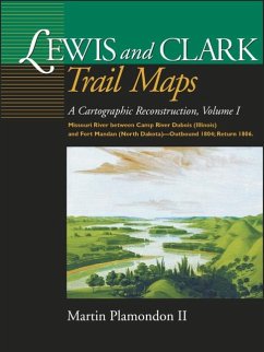
By using measurements and notes in William Clark's journals, Plamondon has created maps depicting the Corps of Discovery's route on the Missouri River from Illinois to North Dakota in 1804. The maps compare the modern beds of streams to their courses at the time of exploration. Of further interest are excerpts from the expedition diaries and an insightful essay on frontier surveying.

Produktbeschreibung
By using measurements and notes in William Clark's journals, Plamondon has created maps depicting the Corps of Discovery's route on the Missouri River from Illinois to North Dakota in 1804. The maps compare the modern beds of streams to their courses at the time of exploration. Of further interest are excerpts from the expedition diaries and an insightful essay on frontier surveying.
Hinweis: Dieser Artikel kann nur an eine deutsche Lieferadresse ausgeliefert werden.
Autorenporträt
Martin Plamondon II of Vancouver, Washington, was a chairman of the Governor's Washington Lewis and Clark Trail Committee. His long-term research in exploration history and 28 years of experience as a professional cartographer provided the unique set of skills required to complete the trail maps.