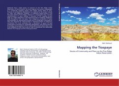
Gathered from a field season of research on the Pine Ridge Indian Reservation of South Dakota, this work explores the author's engagement in a community mapping project with Oglala Lakota elders in 2012. Theories of participatory development are explored as the project intends to "map" the indigenous "tiospaye," or traditional family groups in the Porcupine District of Pine Ridge. Instead of a cartographic map, narrative representations of place develop. A discussion of the mapping project leads to a wider explication of the general practice of mapping indigenous lands throughout time and place. How indigenous perceptions of place and landscape are represented through acts of cartography is discussed to show the potential for empowerment or disempowerment of indigenous worldviews. The work concludes that a divestment of power to local communities is necessary for sustainable development, and further that the knowledge and perceptions of the traditionally-inclined Lakota elders need to be validated on their own terms in order to decolonize the relationship between the tiospayes and the tribal government.
Bitte wählen Sie Ihr Anliegen aus.
Rechnungen
Retourenschein anfordern
Bestellstatus
Storno

