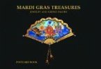
Though the Mardi Gras tradition in New Orleans was always festive, with masked revelers dancing and parading in the streets of the Creole sector, it was not until 1857 that the stunning torchlit procession of the Mistick Krewe of Comus premiered the first floats. In a procession hailed as "a revolution in street pageantry, a revelation in artistic effects," Comus set the scene for the Carnival majesty that continues today. The fantastic parade floats of Carnival's Golden Age (1870-1930) depicted themes drawn from mythology, epic literature, history, nature, and whimsy. The glimmering processions of the masked gods and bearded kings of New Orleans Carnival occupied a central position among the rites and glories of this great festival. The long succession of these glowing, torchlit pageants--with their towering monsters and fantastic dï¿1/2cors, their papier-mï¿1/2chï¿1/2 kingdoms and diamond-dust thrones--became the greatest and most beloved of New Orleans communal rituals. The introduction of the float brought tremendous artistry to the splendid conveyances for Carnival revelry, but the artists and builders who created the fabled pageants have remained obscure or unknown, their amazing body of work largely forgotten. Even the surviving watercolor float plates and chromolithographed Carnival Bulletins are works of art, and prized by collectors, as so few of these fragile items remain. Presented in this collection are dazzling examples of original float designs as rendered in watercolor and lithographs--most of them reproduced here for the first time. Henri Schindler, a New Orleans native, is the acclaimed designer of Mardi Gras parades and balls for some of the city's most eminent societies. He is highly regarded among Carnival historians for his knowledge of the festival's rich cultural legacy and its forgotten artists and builders.
Hinweis: Dieser Artikel kann nur an eine deutsche Lieferadresse ausgeliefert werden.
Hinweis: Dieser Artikel kann nur an eine deutsche Lieferadresse ausgeliefert werden.


