46,99 €
inkl. MwSt.
Versandkostenfrei*
Versandfertig in 6-10 Tagen
  • Broschiertes Buch

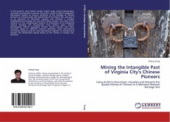
In this research, using historic studies, historic maps, period photographs, and other documentary resources, the author creates a historic Geographic Information System to connect attributes of the heritage of Chinese pioneers in a mining camp with spatial data of the historic site, and uses it as an approach to document, visualize and interpret a complex multidimensional heritage site that lacks historic remains. The result of the research is a rich computerized resource of information of an integrated cultural heritage site documented from historic maps, historic photographs, historic…mehr

Produktbeschreibung
In this research, using historic studies, historic maps, period photographs, and other documentary resources, the author creates a historic Geographic Information System to connect attributes of the heritage of Chinese pioneers in a mining camp with spatial data of the historic site, and uses it as an approach to document, visualize and interpret a complex multidimensional heritage site that lacks historic remains. The result of the research is a rich computerized resource of information of an integrated cultural heritage site documented from historic maps, historic photographs, historic newspaper articles, historic records, and other resources. Based on different research objectives, these documented information aspects could be used separately or together to interpret and visualize the multifaceted spatial history of the Chinese in Virginia City, Montana.
Autorenporträt
Lecturer YANG, Cheng is specialized in the study of world heritage, cultural heritage policy, modern heritage and preservation design for archaeological sites. He currently works at the Xi'an University of Architecture and Technology, and holds the position as the secretary of Docomomo China and UIA Architectural Heritage Work Program in Region IV.