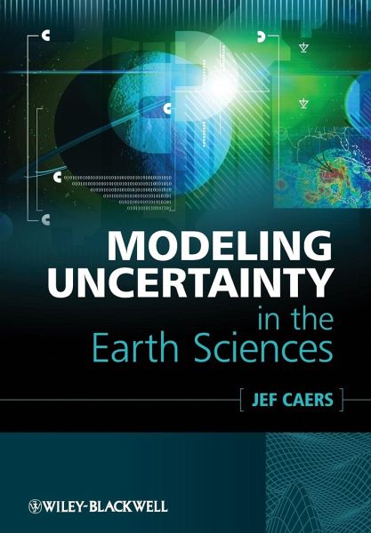
Jef Caers
Modeling Uncertainty in the Earth Sciences
Jef Caers
Modeling Uncertainty in the Earth Sciences
- Broschiertes Buch
- Merkliste
- Auf die Merkliste
- Bewerten Bewerten
- Teilen
- Produkt teilen
- Produkterinnerung
- Produkterinnerung
Modeling Uncertainty in the Earth Sciences highlights the various issues, techniques and practical modeling tools available for modeling the uncertainty of complex Earth systems and the impact that it has on practical situations. The aim of the book is to provide an introductory overview which covers a broad range of tried-and-tested tools. Descriptions of concepts, philosophies, challenges, methodologies and workflows give the reader an understanding of the best way to make decisions under uncertainty for Earth Science problems.
The book covers key issues such as: Spatial and time aspect;…mehr
Andere Kunden interessierten sich auch für
- Murray GrayGeodiversity177,99 €
- José-Maria MonteroSpatial and Spatio-Temporal Geostatistical Modeling and Kriging123,99 €
- Natural History Collections in the Science of the 21st Century189,99 €
- Global Environmental Issues91,99 €
- Global Environmental Issues176,99 €
- Gunilla ObergInterdisciplinary Environmental Studies70,99 €
- Environmental Modelling159,99 €
-
-
-
Modeling Uncertainty in the Earth Sciences highlights the various issues, techniques and practical modeling tools available for modeling the uncertainty of complex Earth systems and the impact that it has on practical situations. The aim of the book is to provide an introductory overview which covers a broad range of tried-and-tested tools. Descriptions of concepts, philosophies, challenges, methodologies and workflows give the reader an understanding of the best way to make decisions under uncertainty for Earth Science problems.
The book covers key issues such as: Spatial and time aspect; large complexity and dimensionality; computation power; costs of 'engineering' the Earth; uncertainty in the modeling and decision process. Focusing on reliable and practical methods this book provides an invaluable primer for the complex area of decision making with uncertainty in the Earth Sciences.
Hinweis: Dieser Artikel kann nur an eine deutsche Lieferadresse ausgeliefert werden.
The book covers key issues such as: Spatial and time aspect; large complexity and dimensionality; computation power; costs of 'engineering' the Earth; uncertainty in the modeling and decision process. Focusing on reliable and practical methods this book provides an invaluable primer for the complex area of decision making with uncertainty in the Earth Sciences.
Hinweis: Dieser Artikel kann nur an eine deutsche Lieferadresse ausgeliefert werden.
Produktdetails
- Produktdetails
- Verlag: Wiley & Sons
- 1. Auflage
- Seitenzahl: 248
- Erscheinungstermin: 5. Juli 2011
- Englisch
- Abmessung: 244mm x 170mm x 14mm
- Gewicht: 532g
- ISBN-13: 9781119992622
- ISBN-10: 1119992621
- Artikelnr.: 33353168
- Herstellerkennzeichnung
- Libri GmbH
- Europaallee 1
- 36244 Bad Hersfeld
- 06621 890
Jef Caers is currently an Assistant Professor of Petroleum Engineering at Stanford University. He is also Director of the Stanford Center for Reservoir Forecasting, an industrial affiliates program in reservoir characterization and modeling. He holds MS and PhD degrees in mining engineering from the Katholicke Universiteit Leuven, Belgium.
Preface xi
Acknowledgements xvii
1 Introduction 1
1.1 Example Application 1
1.1.1 Description 1
1.1.2 3D Modeling 3
1.2 Modeling Uncertainty 4
Further Reading 8
2 Review on Statistical Analysis and Probability Theory 9
2.1 Introduction 9
2.2 Displaying Data with Graphs 10
2.2.1 Histograms 10
2.3 Describing Data with Numbers 13
2.3.1 Measuring the Center 13
2.3.2 Measuring the Spread 14
2.3.3 Standard Deviation and Variance 14
2.3.4 Properties of the Standard Deviation 15
2.3.5 Quantiles and the QQ Plot 15
2.4 Probability 16
2.4.1 Introduction 16
2.4.2 Sample Space, Event, Outcomes 17
2.4.3 Conditional Probability 18
2.4.4 Bayes' Rule 19
2.5 Random Variables 21
2.5.1 Discrete Random Variables 21
2.5.2 Continuous Random Variables 21
2.5.2.1 Probability Density Function (pdf) 21
2.5.2.2 Cumulative Distribution Function 22
2.5.3 Expectation and Variance 23
2.5.3.1 Expectation 23
2.5.3.2 Population Variance 24
2.5.4 Examples of Distribution Functions 24
2.5.4.1 The Gaussian (Normal) Random Variable and Distribution 24
2.5.4.2 Bernoulli Random Variable 25
2.5.4.3 Uniform Random Variable 26
2.5.4.4 A Poisson Random Variable 26
2.5.4.5 The Lognormal Distribution 27
2.5.5 The Empirical Distribution Function versus the Distribution Model 28
2.5.6 Constructing a Distribution Function from Data 29
2.5.7 Monte Carlo Simulation 30
2.5.8 Data Transformations 32
2.6 Bivariate Data Analysis 33
2.6.1 Introduction 33
2.6.2 Graphical Methods: Scatter plots 33
2.6.3 Data Summary: Correlation (Coefficient) 35
2.6.3.1 Definition 35
2.6.3.2 Properties of r 37
Further Reading 37
3 Modeling Uncertainty: Concepts and Philosophies 39
3.1 What is Uncertainty? 39
3.2 Sources of Uncertainty 40
3.3 Deterministic Modeling 41
3.4 Models of Uncertainty 43
3.5 Model and Data Relationship 44
3.6 Bayesian View on Uncertainty 45
3.7 Model Verification and Falsification 48
3.8 Model Complexity 49
3.9 Talking about Uncertainty 50
3.10 Examples 51
3.10.1 Climate Modeling 51
3.10.1.1 Description 51
3.10.1.2 Creating Data Sets Using Models 51
3.10.1.3 Parameterization of Subgrid Variability 52
3.10.1.4 Model Complexity 52
3.10.2 Reservoir Modeling 52
3.10.2.1 Description 52
3.10.2.2 Creating Data Sets Using Models 53
3.10.2.3 Parameterization of Subgrid Variability 53
3.10.2.4 Model Complexity 54
Further Reading 54
4 Engineering the Earth: Making Decisions Under Uncertainty 55
4.1 Introduction 55
4.2 Making Decisions 57
4.2.1 Example Problem 57
4.2.2 The Language of Decision Making 59
4.2.3 Structuring the Decision 60
4.2.4 Modeling the Decision 61
4.2.4.1 Payoffs and Value Functions 62
4.2.4.2 Weighting 63
4.2.4.3 Trade-Offs 65
4.2.4.4 Sensitivity Analysis 67
4.3 Tools for Structuring Decision Problems 70
4.3.1 Decision Trees 70
4.3.2 Building Decision Trees 70
4.3.3 Solving Decision Trees 72
4.3.4 Sensitivity Analysis 76
Further Reading 76
5 Modeling Spatial Continuity 77
5.1 Introduction 77
5.2 The Variogram 79
5.2.1 Autocorrelation in 1D 79
5.2.2 Autocorrelation in 2D and 3D 82
5.2.3 The Variogram and Covariance Function 84
5.2.4 Variogram Analysis 86
5.2.4.1 Anisotropy 86
5.2.4.2 What is the Practical Meaning of a Variogram? 87
5.2.5 A Word on Variogram Modeling 87
5.3 The Boolean or Object Model 87
5.3.1 Motivation 87
5.3.2 Object Models 89
5.4 3D Training Image Models 90
Further Reading 92
6 Modeling Spatial Uncertainty 93
6.1 Introduction 93
6.2 Object-Based Simulation 94
6.3 Training Image Methods 96
6.3.1 Principle of Sequential Simulation 96
6.3.2 Sequential Simulation Based on Training Images 98
6.3.3 Example of a 3D Earth Model 99
6.4 Variogram-Based Methods 100
6.4.1 Introduction 100
6.4.2 Linear Estimation 101
6.4.3 Inverse Square Distance 102
6.4.4 Ordinary Kriging 103
6.4.5 The Kriging Variance 104
6.4.6 Sequential Gaussian Simulation 104
6.4.6.1 Kriging to Create a Model of Uncertainty 104
6.4.6.2 Using Kriging to Perform (Sequential) Gaussian Simulation 104
Further Reading 106
7 Constraining Spatial Models of Uncertainty with Data 107
7.1 Data Integration 107
7.2 Probability-Based Approaches 108
7.2.1 Introduction 108
7.2.2 Calibration of Information Content 109
7.2.3 Integrating Information Content 110
7.2.4 Application to Modeling Spatial Uncertainty 113
7.3 Variogram-Based Approaches 114
7.4 Inverse Modeling Approaches 116
7.4.1 Introduction 116
7.4.2 The Role of Bayes' Rule in Inverse Model Solutions 118
7.4.3 Sampling Methods 125
7.4.3.1 Rejection Sampling 125
7.4.3.2 Metropolis Sampler 128
7.4.4 Optimization Methods 130
Further Reading 131
8 Modeling Structural Uncertainty 133
8.1 Introduction 133
8.2 Data for Structural Modeling in the Subsurface 135
8.3 Modeling a Geological Surface 136
8.4 Constructing a Structural Model 138
8.4.1 Geological Constraints and Consistency 138
8.4.2 Building the Structural Model 140
8.5 Gridding the Structural Model 141
8.5.1 Stratigraphic Grids 141
8.5.2 Grid Resolution 142
8.6 Modeling Surfaces through Thicknesses 144
8.7 Modeling Structural Uncertainty 144
8.7.1 Sources of Uncertainty 146
8.7.2 Models of Structural Uncertainty 149
Further Reading 151
9 Visualizing Uncertainty 153
9.1 Introduction 153
9.2 The Concept of Distance 154
9.3 Visualizing Uncertainty 156
9.3.1 Distances, Metric Space and Multidimensional Scaling 156
9.3.2 Determining the Dimension of Projection 162
9.3.3 Kernels and Feature Space 163
9.3.4 Visualizing the Data-Model Relationship 166
Further Reading 170
10 Modeling Response Uncertainty 171
10.1 Introduction 171
10.2 Surrogate Models and Ranking 172
10.3 Experimental Design and Response Surface Analysis 173
10.3.1 Introduction 173
10.3.2 The Design of Experiments 173
10.3.3 Response Surface Designs 176
10.3.4 Simple Illustrative Example 177
10.3.5 Limitations 179
10.4 Distance Methods for Modeling Response Uncertainty 181
10.4.1 Introduction 181
10.4.2 Earth Model Selection by Clustering 182
10.4.2.1 Introduction 182
10.4.2.2 k-Means Clustering 183
10.4.2.3 Clustering of Earth Models for Response Uncertainty Evaluation 185
10.4.3 Oil Reservoir Case Study 186
10.4.4 Sensitivity Analysis 188
10.4.5 Limitations 191
Further Reading 191
11 Value of Information 193
11.1 Introduction 193
11.2 The Value of Information Problem 194
11.2.1 Introduction 194
11.2.2 Reliability versus Information Content 195
11.2.3 Summary of the VOI Methodology 196
11.2.3.1 Steps 1 and 2: VOI Decision Tree 197
11.2.3.2 Steps 3 and 4: Value of Perfect Information 198
11.2.3.3 Step 5: Value of Imperfect Information 201
11.2.4 Value of Information for Earth Modeling Problems 202
11.2.5 Earth Models 202
11.2.6 Value of Information Calculation 203
11.2.7 Example Case Study 208
11.2.7.1 Introduction 208
11.2.7.2 Earth Modeling 208
11.2.7.3 Decision Problem 209
11.2.7.4 The Possible Data Sources 210
11.2.7.5 Data Interpretation 211
Further Reading 213
12 Example Case Study 215
12.1 Introduction 215
12.1.1 General Description 215
12.1.2 Contaminant Transport 218
12.1.3 Costs Involved 218
12.2 Solution 218
12.2.1 Solving the Decision Problem 218
12.2.2 Buying More Data 219
12.2.2.1 Buying Geological Information 219
12.2.2.2 Buying Geophysical Information 221
12.3 Sensitivity Analysis 221
Index 225