Models in Spatial Analysis
Herausgeber: Sanders, Lena
Models in Spatial Analysis
Herausgeber: Sanders, Lena
- Gebundenes Buch
- Merkliste
- Auf die Merkliste
- Bewerten Bewerten
- Teilen
- Produkt teilen
- Produkterinnerung
- Produkterinnerung
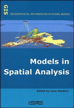
This title provides a broad overview of the different types of models used in advanced spatial analysis. The models concern spatial organization, location factors and spatial interaction patterns from both static and dynamic perspectives. Each chapter gives a broad overview of the subject, covering both theoretical developments and practical applications. The advantages of an interdisciplinary approach are illustrated in the way that the viewpoint of each of the individual disciplines are brought together when considering questions relevant to spatial analysis. The authors of the chapters come…mehr
Andere Kunden interessierten sich auch für
![Fund Spatial Data Quality Fund Spatial Data Quality]() Fund Spatial Data Quality164,99 €
Fund Spatial Data Quality164,99 €![Spatial Management of Risks Spatial Management of Risks]() Spatial Management of Risks164,99 €
Spatial Management of Risks164,99 €![Local Models for Spatial Analysis Local Models for Spatial Analysis]() Christopher D LloydLocal Models for Spatial Analysis135,99 €
Christopher D LloydLocal Models for Spatial Analysis135,99 €![Spatial Context Spatial Context]() Christopher GoldSpatial Context241,99 €
Christopher GoldSpatial Context241,99 €![Spatial Analysis Spatial Analysis]() Spatial Analysis158,99 €
Spatial Analysis158,99 €![The Tarbell Introductory Geography The Tarbell Introductory Geography]() Horace Sumner TarbellThe Tarbell Introductory Geography32,99 €
Horace Sumner TarbellThe Tarbell Introductory Geography32,99 €![Computing in Geographic Information Systems Computing in Geographic Information Systems]() Narayan PanigrahiComputing in Geographic Information Systems151,99 €
Narayan PanigrahiComputing in Geographic Information Systems151,99 €-
-
-
This title provides a broad overview of the different types of models used in advanced spatial analysis. The models concern spatial organization, location factors and spatial interaction patterns from both static and dynamic perspectives. Each chapter gives a broad overview of the subject, covering both theoretical developments and practical applications. The advantages of an interdisciplinary approach are illustrated in the way that the viewpoint of each of the individual disciplines are brought together when considering questions relevant to spatial analysis. The authors of the chapters come from a range of different disciplines (geography, economy, hydrology, ecology, etc.) and are specialists in their field. They use a range of methods and modeling tools developed in mathematics, statistics, artificial intelligence and physics.
Produktdetails
- Produktdetails
- Verlag: Wiley
- Seitenzahl: 319
- Erscheinungstermin: 1. Mai 2007
- Englisch
- Abmessung: 235mm x 163mm x 23mm
- Gewicht: 653g
- ISBN-13: 9781905209095
- ISBN-10: 1905209096
- Artikelnr.: 21165146
- Herstellerkennzeichnung
- Libri GmbH
- Europaallee 1
- 36244 Bad Hersfeld
- gpsr@libri.de
- Verlag: Wiley
- Seitenzahl: 319
- Erscheinungstermin: 1. Mai 2007
- Englisch
- Abmessung: 235mm x 163mm x 23mm
- Gewicht: 653g
- ISBN-13: 9781905209095
- ISBN-10: 1905209096
- Artikelnr.: 21165146
- Herstellerkennzeichnung
- Libri GmbH
- Europaallee 1
- 36244 Bad Hersfeld
- gpsr@libri.de
Lena Sanders is a senior scientist in geography at the CNRS (Centre National de la Recherche Scientifique), France, specializing in urban geography, spatial analysis and dynamic modeling. She is Director of Géographie-cités, a research laboratory of CNRS-University Paris 1-University Paris 7, France.
Preface xiii
Introduction xv
Chapter 1. Modeling Concepts Used in Spatial Analysis 1
François DURAND-DASTÈS
1.1. Introduction 1
1.2. Modeling universals 2
1.2.1. Logical frames for modeling 2
1.2.2. The language of models 6
1.2.2.1. Material or physical model languages 6
1.2.2.2. The language of images: iconic models 7
1.2.2.3. Modeling in mathematical language 9
1.3. A few specific features of spatial models 11
1.4. Spatial models: a study grid 16
1.4.1. Sequencing and explanation 16
1.4.2. The group and the individual 18
1.4.3. The random and the determined 20
1.4.4. Movement and balance 21
1.5. Conclusion 25
1.6. Bibliography 26
Chapter 2. Geographical Scales and Multidimensional Statistical Methods 29
Hélène MATHIAN and Marie PIRON
2.1. Introduction 29
2.2. Scaling issues 31
2.2.1. The consideration of different geographical levels: two possible
approaches 31
2.2.2. Formalization of relations between two levels 33
2.2.2.1. Nested relations and partition graph 33
2.2.2.2. Neighborhood relations and proximity graphs 35
2.2.3. Processing of multilevel information 37
2.2.3.1. Multilevel structure and attributes 37
2.2.3.2. Multidimensional statistical methods 39
2.3. Change of levels, change of structures 40
2.3.1. Scale and variability 41
2.3.2. Exploratory analysis of the scale system 41
2.3.2.1. Analysis of aggregated levels or interclass analysis 43
2.3.2.2. Transition analysis between two levels or intraclass analysis 45
2.3.3. Application of outlying Ouagadougou space to the social and spatial
organization 46
2.4. Integration of the different levels 51
2.4.1. The scale: a set of territorial and spatial references 51
2.4.2. The analysis of local differences 55
2.4.3. Other local analysis methods 58
2.5. Multilevel models 59
2.5.1. Contextual effects and regression models 60
2.5.2. Multilevel modeling 65
2.6. Conclusion 68
2.7. Bibliography 69
Chapter 3. Location of Public Services: From Theory to Application 73
Dominique PEETERS and Isabelle THOMAS
3.1. Introduction 73
3.2. The modeling approach 75
3.2.1. A typology of public services: an attempt 76
3.2.2. Estimating demand 77
3.2.3. Analyzing supply 78
3.2.4. Adjusting supply to demand 79
3.2.5. Evaluating the solutions 82
3.2.6. Methodological perspectives 83
3.3. A prototype location model: the k-median 84
3.4. An example: recycling centers 86
3.4.1. The problem: the optimal location of recycling centers 86
3.4.2. Results of the model 88
3.5. Conclusion 91
3.6. Bibliography 92
Chapter 4. Time-geography: Individuals in Time and Space 97
Sonia CHARDONNEL
4.1. Introduction: why integrate "time" when we analyze space? 97
4.1.1. The study of spatio-temporal processes 97
4.1.2. For a time-integrated geography 98
4.2. The foundations of time-geography 99
4.2.1. The premises 99
4.2.2. A certain vision of the world 100
4.3. The conceptual framework of time-geography 102
4.3.1. The creation of a "notation system" 102
4.3.2. Tools to decrypt daily life 103
4.3.2.1. Trajectory, station, project: basic concepts 103
4.3.2.2. Different types of constraints 105
4.3.2.3. A transversal analysis of the "three worlds" 109
4.4. Time-geography in practice 110
4.4.1. Simulation of individual activity programs: public transport
possibilities in the city of Karlstad - an application by Bo Lenntorp 111
4.4.1.1. General features of the simulation model 111
4.4.1.2. The application of Karlstad 111
4.4.1.3. New implementations and operational methods in time-geographic
research 115
4.4.1.4. Partial conclusion 118
4.4.2. Daily lives of women: adaptation strategies in time and space - the
Tora Friberg method 118
4.4.2.1. From Højrup's life forms to Friberg's three women life forms 119
4.4.2.2. Relation with time-geography 120
4.5. Conclusion 121
4.6. Bibliography 122
Chapter 5. The Process of Spatial Diffusion and Modeling Change 127
Thérèse SAINT-JULIEN
5.1. Introduction 127
5.2. The manifestations of diffusion in space 128
5.2.1. Elements and levels of approach of a spatial diffusion process 129
5.2.2. Distances and propagation channels 131
5.2.3. Spatial diffusion in time 136
5.3. Simulating a spatial diffusion process: Hägerstrand's pioneer approach
137
5.3.1. A probabilistic model 138
5.3.2. The rules of the basic model 139
5.3.2.1. Diffusion in a homogenous space 139
5.3.2.2. Diffusion in a heterogeneous space 139
5.3.3. Simulation procedure 141
5.4. Analysis models, interpretative models 143
5.4.1. References 143
5.4.2. Models of form 145
5.4.3. Explanatory models 149
5.5. Conclusion 153
5.6. Bibliography 153
Chapter 6. Spatial Microsimulation Models 159
Einar HOLM and Lena SANDERS
6.1. Introduction 159
6.2. Choosing the aggregation level for modeling 160
6.2.1. "Micro-objects" and spatial analysis 161
6.2.1.1. Arguments for choosing a modeling level 161
6.2.1.2. Individuals as the favored micro-objects in spatial
microsimulation 164
6.2.2. Theoretical point of view: interactions and emergence phenomena 169
6.2.3. Thematic point of view: the driving role of the inter-individual
diversity 170
6.2.4. Technical point of view: management of information tables 171
6.3. The elements of a dynamic microsimulation model .172
6.3.1. The different sources of microdata: comprehensive information,
samplings, artificial worlds 172
6.3.2. Statistical procedures or agent type autonomy: the different ways to
formalize individual change 176
6.4. National forecasts and simulation of individual biographies with the
SVERIGE model 178
6.4.1. Classical aggregate outputs 179
6.4.2. The biography of Kristina 181
6.5. A simulation of population spatial dynamics with MICDYN 185
6.5.1. Operation of the MICDYN model 185
6.5.2. Determining workplaces and places of residence of migrants 187
6.5.3. Simulating the population evolutions 1990-2040 188
6.5.4. Perspectives 191
6.6. Conclusion 192
6.7. Bibliography 193
Chapter 7. Multi-agent Simulations of Spatial Dynamics 197
Jean-Pierre TREUIL, Christian MULLON, Edith PERRIER and Marie PIRON
7.1. Introduction 197
7.2. The multi-agent approach 199
7.2.1. Multi-agent systems 200
7.2.2. Multi-agent simulation of natural and social phenomena 204
7.3. Modeling of spatial dynamics 206
7.3.1. Computer models and simulation of spatial dynamics 207
7.3.1.1. An example: modeling of the ecosystem of the interior delta of the
river Niger 207
7.3.1.2. The concepts of a computer model of spatial dynamics 210
7.3.2. Mathematical models of spatial dynamics 212
7.3.2.1. Eulerian and Lagrangian approaches 212
7.3.2.2. An example on water runoff modeling 216
7.3.3. Computer and mathematical models of spatial dynamics toward
convergence 219
7.3.3.1. A common duality: Eulerian point of view and Lagrangian point of
view 219
7.3.3.2. Source and necessity of the comparison: simulation and its limits
220
7.4. The multi-agent approach in spatial dynamics modeling: a point of view
222
7.4.1. The methodology 222
7.4.2. Hierarchy of choices and the place of agents: an example 223
7.5. Conclusion 224
7.6. Bibliography 225
Chapter 8. From Image to Model: Remote Sensing and Urban Modeling 231
Françoise DUREAU and Christiane WEBER
8.1. Introduction 231
8.1.1. A modeling of urban reality 232
8.1.2. Objectives of the chapter 233
8.2. The satellite image in the demographic information production 237
8.2.1. The different phases of information production from satellite
imagery 238
8.2.2. Area sampling method on satellite image: general principles 239
8.2.3. Application in Bogota in 1993 240
8.3. The use of imagery in urban modeling 242
8.3.1. The potential model and satellite data 242
8.3.2. Application of the model to satellite imagery 244
8.3.3. Application in Bogota 247
8.4. Spatial information and dynamic modeling 253
8.4.1. Towards a dynamic multilevel model 255
8.4.2. Application in Bogota: a preliminary simulation 255
8.5. Conclusion 257
8.6. Bibliography 258
Chapter 9. Mathematical Formalization for Spatial Interactions 261
Alain FRANC
9.1. Introduction 261
9.2. Formalizations 264
9.3. Notion of perfect aggregation of variables 267
9.4. Mean field 269
9.5. Example of the Ising model 271
9.6. Use of mean field notion in ecology 273
9.7. Reaction-diffusion models 275
9.8. Conclusion 277
9.9. Bibliography 278
Chapter 10. Fractals and Geography 281
Pierre FRANKHAUSER and Denise PUMAIN
10.1. Introduction 281
10.2. Fractality and structuring of the geographical space 282
10.2.1. Density: a traditional but unsuitable measure 282
10.2.2. The fractals: references adapted to the space of human societies
284
10.3. Fractal models of spatial structures 286
10.3.1. Surface models 286
10.3.2. Line models 288
10.3.3. Multifractal models 290
10.3.4. Stochastic models 290
10.4. Measuring fractality 290
10.4.1. Notion of fractal dimension 291
10.4.2. Global analysis methods 292
10.4.2.1. The grid analysis 292
10.4.2.2. The correlation analysis 293
10.4.3. Local methods of analysis 293
10.4.3.1. Radial analysis 293
10.4.3.2. The curve of scaling behavior 294
10.5. The morphology of contours 295
10.6. The morphology of land occupation 296
10.6.1. Form of occupied surfaces 296
10.6.2. Intensity of land occupation 300
10.7. The morphology of hierarchies: population and systems 302
10.7.1. Urban hierarchies 302
10.7.2. Measuring the morphology of networks 302
10.8. Towards dynamic models 304
10.9. Conclusion 306
10.10. Bibliography 308
List of Authors 313
Index 317

