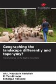
Using a new approach, both vernacular and scientific, integrated into the Multimedia GIS prototype, the aim is to respond to the main hypothesis underpinning all this research: the principle of co-management can reduce the vulnerability of pastoral populations living in UNESCO-labeled territories.This vulnerability is greater today because of climate change. For this reason, we have chosen to focus on Morocco's RBA, as it bears witness to anthropic pressure on the natural environment. What contribution can Multimedia GIS make to the co-management of pastoral resources and innovation in UNESCO-labeled territories?
Bitte wählen Sie Ihr Anliegen aus.
Rechnungen
Retourenschein anfordern
Bestellstatus
Storno

