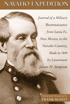
In 1849, the Corps of Topographical Engineers commissioned Lieutenant James H. Simpson to undertake the first survey of Navaho country in present-day New Mexico. Accompanying Simpson was a military force commanded by Colonel John M. Washington, sent to negotiate peace with the Navaho Indians. A keen observer, Simpson kept a journal that provided valuable information on the party's interactions with Indians and also about the land's features, including important pueblo ruins at Chaco Canyon and Canyon de Chelly. His careful observations informed subsequent military expeditions, emigrant trains, the selection of Indian reservations, and the charting of a transcontinental railroad. Editor Frank McNitt discusses the expedition's lasting importance to the development of the West, and his research is enriched by illustrations and maps by artists Richard and Edward Kern. Military historian Durwood Ball contributes a new foreword.
Bitte wählen Sie Ihr Anliegen aus.
Rechnungen
Retourenschein anfordern
Bestellstatus
Storno

