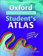
The Oxford International Student Atlas is an up-to-date with content modified to support the most popular overseas curriculum including UK and IB
The atlas contains comprehensive coverage of the countries and oceans of the world, together with an eight-page world statistical section. There are clear and colourful continental thematic maps illustrating a variety of subjects as well as world maps on motivating topics such as cyberspace, globalisation, alliances, and the world's most exciting holiday destinations. Easy-to-use features include a multi-access contents page, a two-colour index of place names, and flags of the world
at a usable size. This is an ideal resource for secondary geography.

