Participatory Spatial Modeling for Human Elephant Conflict Management
Versandkostenfrei!
Versandfertig in 6-10 Tagen
27,99 €
inkl. MwSt.

PAYBACK Punkte
14 °P sammeln!
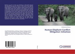
This book major emphasis is to develop a better decisions tool to enable all stakeholder participation and understand the situation at various levels thus to devise a strategy for the conservation and local livelihood improvement success. The methodologies devised have been tested to address those challenges using feasible geospatial technologies such as P3DM as a tool to experiment human-elephant conflict management and incorporate ancillary data from stakeholder analysis workshop, previous research, field survey, Elephant collar GPS tracks, Land use map, Socioeconomic survey and various disc...
This book major emphasis is to develop a better decisions tool to enable all stakeholder participation and understand the situation at various levels thus to devise a strategy for the conservation and local livelihood improvement success. The methodologies devised have been tested to address those challenges using feasible geospatial technologies such as P3DM as a tool to experiment human-elephant conflict management and incorporate ancillary data from stakeholder analysis workshop, previous research, field survey, Elephant collar GPS tracks, Land use map, Socioeconomic survey and various discussions including the various community talks. Thus Conservation, then, cannot come about by haphazard paths that entail trials and errors. One of the best ways of conserving and making best use of BES's vast resources is to know important aspects of Actions of who, what, where and when considering all biophysical issues with social factors and understand the spatiotemporal phenomena and identify the key elements for a participatory decision that bring a sustainable solution so as to ensure the peaceful co-existence of human & wildlife.


