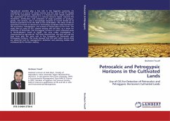
Petrocalcic and Petrogypsic Horizons in the Cultivated Lands
Use of GIS for Detection of Petrocalcic and Petrogypsic Horizonsin Cultivated Lands
Versandkostenfrei!
Versandfertig in 6-10 Tagen
45,99 €
inkl. MwSt.

PAYBACK Punkte
23 °P sammeln!
Agricultural activities play a key role in the Egyptian economy, it's considered as a source of nation income and the way of life for sizable part of the population. Agriculture is a business sector ideally suited for the application of GIS because it is natural resource based, requires the movement, distribution, and utilization of large quantities of products, goods, and services, and is increasingly required to record details of its business operations from the field to the marketplace. The value of GIS to agriculture increases as advances in technology accelerate opportunities for the acqu...
Agricultural activities play a key role in the Egyptian economy, it's considered as a source of nation income and the way of life for sizable part of the population. Agriculture is a business sector ideally suited for the application of GIS because it is natural resource based, requires the movement, distribution, and utilization of large quantities of products, goods, and services, and is increasingly required to record details of its business operations from the field to the marketplace. The value of GIS to agriculture increases as advances in technology accelerate opportunities for the acquisition, management, and analysis of spatial data on the farm. The study aims at using of GIS, remote sensing and soil data, as a mean for detection of Petrocalcic and Petrogypsic horizons in some cultivated areas in North-Western Coast of Egypt. The area under investigation is characterized by agricultural. This study showed that, the land use and the land form play the main role in the formation of Petrocalcic and Petrogypsic horizons. This study showed that GIS with other source data are powerful tool for management, detection and planning studies and consequently for decision making.


