- Broschiertes Buch
- Merkliste
- Auf die Merkliste
- Bewerten Bewerten
- Teilen
- Produkt teilen
- Produkterinnerung
- Produkterinnerung
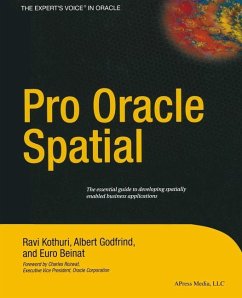
With growing reliance on spatial components for making critical and strategic decisions, there is great incentive to maximize the added value of spatial data. Enter Pro Oracle Spatial. This highly anticipated book examines the potential for organizations to exploit spatial information by way of Oracle Spatial.
Included are case studies of advanced spatial applications in healthcare, telecom, retail, and distribution industries. Further, the content is based on extensive feedback from training courses, discussion lists, and customers. This talented author team will also suggest best-practice approaches to common problems. …mehr
Andere Kunden interessierten sich auch für
![Pro Oracle Spatial for Oracle Database 11g Pro Oracle Spatial for Oracle Database 11g]() Ravikanth KothuriPro Oracle Spatial for Oracle Database 11g44,99 €
Ravikanth KothuriPro Oracle Spatial for Oracle Database 11g44,99 €![Pro Oracle Spatial for Oracle Database 11g Pro Oracle Spatial for Oracle Database 11g]() Ravikanth KothuriPro Oracle Spatial for Oracle Database 11g44,99 €
Ravikanth KothuriPro Oracle Spatial for Oracle Database 11g44,99 €![Software Development on a Leash Software Development on a Leash]() David BirminghamSoftware Development on a Leash33,99 €
David BirminghamSoftware Development on a Leash33,99 €![Introduction to Constraint Databases Introduction to Constraint Databases]() Peter ReveszIntroduction to Constraint Databases40,99 €
Peter ReveszIntroduction to Constraint Databases40,99 €![Advances in Spatial and Temporal Databases Advances in Spatial and Temporal Databases]() Thanasis Hadzilacos / Yannis Manolopoulos / John F. Roddick / Yannis Theodoridis (eds.)Advances in Spatial and Temporal Databases81,99 €
Thanasis Hadzilacos / Yannis Manolopoulos / John F. Roddick / Yannis Theodoridis (eds.)Advances in Spatial and Temporal Databases81,99 €![Spatial Information Theory Spatial Information Theory]() Stephan Winter (Volume ed.) / Matt Duckham / Lars Kulik / Ben KuipersSpatial Information Theory39,99 €
Stephan Winter (Volume ed.) / Matt Duckham / Lars Kulik / Ben KuipersSpatial Information Theory39,99 €![Pro Entity Framework Core 2 for ASP.NET Core MVC Pro Entity Framework Core 2 for ASP.NET Core MVC]() Adam FreemanPro Entity Framework Core 2 for ASP.NET Core MVC67,99 €
Adam FreemanPro Entity Framework Core 2 for ASP.NET Core MVC67,99 €-
-
-
With growing reliance on spatial components for making critical and strategic decisions, there is great incentive to maximize the added value of spatial data. Enter Pro Oracle Spatial. This highly anticipated book examines the potential for organizations to exploit spatial information by way of Oracle Spatial.
Included are case studies of advanced spatial applications in healthcare, telecom, retail, and distribution industries. Further, the content is based on extensive feedback from training courses, discussion lists, and customers. This talented author team will also suggest best-practice approaches to common problems.
Included are case studies of advanced spatial applications in healthcare, telecom, retail, and distribution industries. Further, the content is based on extensive feedback from training courses, discussion lists, and customers. This talented author team will also suggest best-practice approaches to common problems.
Produktdetails
- Produktdetails
- Verlag: Apress / Springer, Berlin
- Artikelnr. des Verlages: 978-1-4302-5305-1
- Softcover reprint of the original 1st ed.
- Seitenzahl: 712
- Erscheinungstermin: 28. Mai 2013
- Englisch
- Abmessung: 235mm x 191mm x 38mm
- Gewicht: 1313g
- ISBN-13: 9781430253051
- ISBN-10: 1430253053
- Artikelnr.: 39916030
- Herstellerkennzeichnung
- Libri GmbH
- Europaallee 1
- 36244 Bad Hersfeld
- gpsr@libri.de
Ravi Kothuri holds a Ph.D. in computer science from the University of California, Santa Barbara, and has been an active researcher and developer in the spatial and multimedia areas for the past 12 years. He serves as the project lead and software architect for various projects in Oracle Spatial. He has around 15 patents (some pending) on specific Oracle technology and has authored numerous articles for database conferences and journals. Other activities include teaching database courses for undergrads and reviewing of research articles for spatial and database conferences. Ravi enjoys music, movies, and playing with children.
1 Overview.- 1 Spatial Information Management.- 2 Overview of Oracle Spatial.- 3 Location-Enabling Your Applications.- 2 Basic Spatial.- 4 The SDO_GEOMETRY Data Type.- 5 Loading, Transporting, and Validating Spatial Data.- 6 Geocoding.- 7 Manipulating SDO_GEOMETRY in Application Programs.- 3 Analysis and Visualization.- 8 Spatial Indexes and Operators.- 9 Geometry Processing Functions.- 10 Network Modeling.- 11 Generating Maps Using MapViewer.- 12 A Sample Application.- 4 Advanced Spatial.- 13 Case Studies.- 14 Tips, Common Mistakes, and Common Errors.- Appendix A Additional Spatial Analysis Functions.- Tiling-Based Analysis.- TILED_BINS.- TILED_AGGREGATES.- Neighborhood Analysis.- AGGREGATES_FOR_GEOMETRY.- AGGREGATES_FOR_LAYER.- Clustering Analysis.- SPATIAL_CLUSTERS.- Refining the Candidates for Site Selection.- Geometry Simplification for Speeding Up Analysis.- Summary.- Appendix B Linear Referencing.- Concepts and Definitions.- Measure.- Linear Referenced Segments.- Direction.- Shape Points.- Offset.- Typical Application.- Creating Linear Referenced Geometries.- SDO_GTYPE in LRS Geometries.- Constructing LRS Geometries.- Metadata.- Spatial Indexes and Spatial Operators on LRS Geometries.- Dynamic Segmentation Operations.- Clip a Segment.- Locate a Point.- Project a Point.- Validation of LRS Segments.- Dynamic Segmentation on 3D Geometries.- Other Operations.- Summary.- Appendix C Topology Data Model in Oracle.- Topology Data Model.- Benefits of the Topology Data Model.- Storing a Topology Data Model in Oracle.- Operating on a Topology in Oracle.- Creating a Topology.- Associating a Feature Layer with a Topology.- Inserting, Updating, and Populating Feature Layers.- Updating Topological Elements.- Querying for Topological Relationships.- Hierarchical Feature Model.-Summary.- Appendix D Storing Raster Data in Oracle.- SDO_GEORASTER Data Type.- Storage for SDO_GEORASTER Data.- Metadata in SDO_GEORASTER Data.- Populating SDO_GEORASTER Columns.- Manipulating Raster Objects.- Generating Pyramids.- Subsetting.- Georeferencing.- Visualizing Raster Data in Oracle MapViewer.- Summary.
1 Overview.- 1 Spatial Information Management.- 2 Overview of Oracle Spatial.- 3 Location-Enabling Your Applications.- 2 Basic Spatial.- 4 The SDO_GEOMETRY Data Type.- 5 Loading, Transporting, and Validating Spatial Data.- 6 Geocoding.- 7 Manipulating SDO_GEOMETRY in Application Programs.- 3 Analysis and Visualization.- 8 Spatial Indexes and Operators.- 9 Geometry Processing Functions.- 10 Network Modeling.- 11 Generating Maps Using MapViewer.- 12 A Sample Application.- 4 Advanced Spatial.- 13 Case Studies.- 14 Tips, Common Mistakes, and Common Errors.- Appendix A Additional Spatial Analysis Functions.- Tiling-Based Analysis.- TILED_BINS.- TILED_AGGREGATES.- Neighborhood Analysis.- AGGREGATES_FOR_GEOMETRY.- AGGREGATES_FOR_LAYER.- Clustering Analysis.- SPATIAL_CLUSTERS.- Refining the Candidates for Site Selection.- Geometry Simplification for Speeding Up Analysis.- Summary.- Appendix B Linear Referencing.- Concepts and Definitions.- Measure.- Linear Referenced Segments.- Direction.- Shape Points.- Offset.- Typical Application.- Creating Linear Referenced Geometries.- SDO_GTYPE in LRS Geometries.- Constructing LRS Geometries.- Metadata.- Spatial Indexes and Spatial Operators on LRS Geometries.- Dynamic Segmentation Operations.- Clip a Segment.- Locate a Point.- Project a Point.- Validation of LRS Segments.- Dynamic Segmentation on 3D Geometries.- Other Operations.- Summary.- Appendix C Topology Data Model in Oracle.- Topology Data Model.- Benefits of the Topology Data Model.- Storing a Topology Data Model in Oracle.- Operating on a Topology in Oracle.- Creating a Topology.- Associating a Feature Layer with a Topology.- Inserting, Updating, and Populating Feature Layers.- Updating Topological Elements.- Querying for Topological Relationships.- Hierarchical Feature Model.-Summary.- Appendix D Storing Raster Data in Oracle.- SDO_GEORASTER Data Type.- Storage for SDO_GEORASTER Data.- Metadata in SDO_GEORASTER Data.- Populating SDO_GEORASTER Columns.- Manipulating Raster Objects.- Generating Pyramids.- Subsetting.- Georeferencing.- Visualizing Raster Data in Oracle MapViewer.- Summary.

