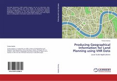
Producing Geographical Information for Land Planning using VHR Data
Local Scale Applications
Versandkostenfrei!
Versandfertig in 6-10 Tagen
52,99 €
inkl. MwSt.

PAYBACK Punkte
26 °P sammeln!
Very-High Resolution (VHR) satellite imagery can be an alternative data source, without replacing the aerial images, for producing large-scale thematic cartography. The focus of the thesis is the demand for updated geographic information in the land planning process. The proposed methodology is based on the use of VHR satellite imagery, and other digital data, in a Geographic Information Systems (GIS) environment.


