Re-envisioning Remote Sensing Applications
Perspectives from Developing Countries
Herausgeber: Singh, Ripudaman
Re-envisioning Remote Sensing Applications
Perspectives from Developing Countries
Herausgeber: Singh, Ripudaman
- Gebundenes Buch
- Merkliste
- Auf die Merkliste
- Bewerten Bewerten
- Teilen
- Produkt teilen
- Produkterinnerung
- Produkterinnerung
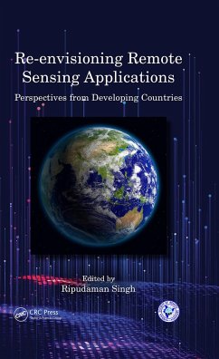
Re-envisioning Remote Sensing Applications: Perspectives from Developing Countries aims at discussing varied applications of remote sensing, with respect to upcoming technologies with varied themes like agricultural, soil and land degradation studies, hydrology, microclimates and climate change, land-use/land cover analysis, and so forth.
Andere Kunden interessierten sich auch für
![Remote Sensing and Digital Image Processing with R Remote Sensing and Digital Image Processing with R]() Marcelo de Carvalho Alves (Brazil Federal University of Lavras)Remote Sensing and Digital Image Processing with R156,99 €
Marcelo de Carvalho Alves (Brazil Federal University of Lavras)Remote Sensing and Digital Image Processing with R156,99 €![Fundamentals of Satellite Remote Sensing Fundamentals of Satellite Remote Sensing]() Emilio Chuvieco (Universidad de Alcala, Alcala de Henares, Spain)Fundamentals of Satellite Remote Sensing157,99 €
Emilio Chuvieco (Universidad de Alcala, Alcala de Henares, Spain)Fundamentals of Satellite Remote Sensing157,99 €![Urban Remote Sensing Urban Remote Sensing]() Urban Remote Sensing66,99 €
Urban Remote Sensing66,99 €![LiDAR Remote Sensing and Applications LiDAR Remote Sensing and Applications]() Pinliang Dong (University of North Texas, Denton, USA)LiDAR Remote Sensing and Applications127,99 €
Pinliang Dong (University of North Texas, Denton, USA)LiDAR Remote Sensing and Applications127,99 €![GIS Cartography GIS Cartography]() Gretchen N. Peterson (PetersonGIS, Seattle, Washington, USA)GIS Cartography64,99 €
Gretchen N. Peterson (PetersonGIS, Seattle, Washington, USA)GIS Cartography64,99 €![Fundamentals of Satellite Remote Sensing Fundamentals of Satellite Remote Sensing]() Emilio Chuvieco (Universidad de Alcala, Alcala de Henares, Spain)Fundamentals of Satellite Remote Sensing71,99 €
Emilio Chuvieco (Universidad de Alcala, Alcala de Henares, Spain)Fundamentals of Satellite Remote Sensing71,99 €![Thematic Cartography and Geovisualization Thematic Cartography and Geovisualization]() Terry A. Slocum (USA University of Kansas)Thematic Cartography and Geovisualization195,99 €
Terry A. Slocum (USA University of Kansas)Thematic Cartography and Geovisualization195,99 €-
-
-
Re-envisioning Remote Sensing Applications: Perspectives from Developing Countries aims at discussing varied applications of remote sensing, with respect to upcoming technologies with varied themes like agricultural, soil and land degradation studies, hydrology, microclimates and climate change, land-use/land cover analysis, and so forth.
Produktdetails
- Produktdetails
- Verlag: Taylor & Francis Ltd
- Seitenzahl: 346
- Erscheinungstermin: 4. März 2021
- Englisch
- Abmessung: 229mm x 152mm x 21mm
- Gewicht: 630g
- ISBN-13: 9780367502393
- ISBN-10: 0367502399
- Artikelnr.: 60597037
- Herstellerkennzeichnung
- Libri GmbH
- Europaallee 1
- 36244 Bad Hersfeld
- gpsr@libri.de
Ripudaman Singh, presently teaching as Professor of Geography at Lovely Professional University. After completing his doctoral research from Panjab University, Chandigarh through UGC-JRF/SRF fellowships, he has been faculty to various institutions including Post Graduate Government College, Sector-11, Chandigarh (2005-2010); Central University of Punjab, Bathinda (2010-2011); and Lyallpur Khalsa College, Jalandhar (2011-2012), and Lovely Professional University, Phagwara (Since 2012). He has also served Government College, Hoshiarpur (2004) on honorary basis and Panjab University, Chandigarh as Guest Faculty (2005-2006). He has been a recipient of 'Young Geographers Award' from National Association of Geographers, India (NAGI) in 2005. He has special interest in Development Geography, Remote Sensing & GIS, Geography of India, Political Geography, Regional Development & Planning and Disaster Management. He has published more than forty research papers in reputed national and international journals and three books to his credit. His other two books are under publication.
Prologue: Re-envisioning Remote Sensing Applications; Section I
Agricultural, Soil and Land Degradation Studies 1. Wheat Yield Prediction
through Spectral Indices using Agro-Meteorological Data 2. Impact of
Variation in Agro-Meteorological Parameters on Wheat Production and
Comparison of Yield Predicted by Agro-Meteorological Indices 3.
Geostationary Meteorological Satellite for Agrometeorological Applications
4. Prediction of urban expansion and identifying its impacts on the
degradation of agricultural land: A machine learning-based Remote sensing
approach in Rajshahi, Bangladesh; Section II Hydrology, Microclimates and
Climate Change Impacts 5. Spatio-Temporal Variations of Water Surface
Temperature and its effect on Microclimate of Sukhna Lake in Chandigarh
(India) 6. Assessing the Impact of Climate Variables on Soil Salinity using
Remote Sensing and GIS 7. Monitoring Climate Change induced Variations in
the Indian Sundarbans Region using Geospatial Sciences 8. Remote Sensing of
Photosynthesis, Vegetation Productivity and Climate Variability on
Bangladesh;
Section III Land-use/ Land cover Analysis Applications 9. Rural Land
Transformation in Chandigarh Periphery: A Spatio-Temporal Analysis 10.
Examining the Temporal Change in Land-cover/Land-use in Five Watersheds in
Goa, India using a Geospatial Approach 11. Impacts of Land Use and Land
Cover Change on Land Degradation: A case study in Dolakha District, Nepal
12. Remote sensing-based approach to identify the influence of land
use/land cover change on the urban thermal environment: A case study in
Chattogram City, Bangladesh 13. Modeling Land Use Land Cover Change Using
Multi-Layer Perceptron and Markov Chain Analysis: A Study on Bahir Dar
City, Ethiopia 14. Geoinformatics Approach in Desertification Evaluation
using Vegetation Cover Changes in the Sudano-Sahelian Region of Nigeria
from 2000 to 2010; Section IV Resource Analysis and Bibliometric Studies
15. Role of Geospatial Technology in Crop Growth Monitoring and Yield
Estimation 16. Remote Sensing Applications for Crop Residue Burning
Assessments: A Review 17. Indian Water Resources Research using Remote
Sensing as reflected by Web of Science during 2009-2018: A Bibliometric
Study 18. Research Practice on Remote Sensing: A Bibliometric Study of
Indian Scholars; Epilogue: Future Research Agenda

