Marcelo de Carvalho Alves (Brazil Federal University of Lavras), Luciana Sanches (Brazil Federal University of Mato Grosso)
Remote Sensing and Digital Image Processing with R - Lab Manual
Marcelo de Carvalho Alves (Brazil Federal University of Lavras), Luciana Sanches (Brazil Federal University of Mato Grosso)
Remote Sensing and Digital Image Processing with R - Lab Manual
- Broschiertes Buch
- Merkliste
- Auf die Merkliste
- Bewerten Bewerten
- Teilen
- Produkt teilen
- Produkterinnerung
- Produkterinnerung
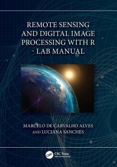
A companion to Remote Sensing and Digital Image Processing with R, this lab manual covers examples of natural resource data analysis applications including practical, problem-solving exercises and case studies that use the free and open-source platform R.
Andere Kunden interessierten sich auch für
![Remote Sensing and Digital Image Processing with R Remote Sensing and Digital Image Processing with R]() Marcelo de Carvalho Alves (Brazil Federal University of Lavras)Remote Sensing and Digital Image Processing with R156,99 €
Marcelo de Carvalho Alves (Brazil Federal University of Lavras)Remote Sensing and Digital Image Processing with R156,99 €![Re-envisioning Remote Sensing Applications Re-envisioning Remote Sensing Applications]() Re-envisioning Remote Sensing Applications98,99 €
Re-envisioning Remote Sensing Applications98,99 €![Wetlands and Habitats Wetlands and Habitats]() Wetlands and Habitats50,99 €
Wetlands and Habitats50,99 €![Surveying with Geomatics and R Surveying with Geomatics and R]() Marcelo de Carvalho Alves (Brazil Federal University of Lavras)Surveying with Geomatics and R63,99 €
Marcelo de Carvalho Alves (Brazil Federal University of Lavras)Surveying with Geomatics and R63,99 €![Fundamentals of Satellite Remote Sensing Fundamentals of Satellite Remote Sensing]() Emilio Chuvieco (Universidad de Alcala, Alcala de Henares, Spain)Fundamentals of Satellite Remote Sensing157,99 €
Emilio Chuvieco (Universidad de Alcala, Alcala de Henares, Spain)Fundamentals of Satellite Remote Sensing157,99 €![Urban Expansion, Land Cover and Soil Ecosystem Services Urban Expansion, Land Cover and Soil Ecosystem Services]() Urban Expansion, Land Cover and Soil Ecosystem Services60,99 €
Urban Expansion, Land Cover and Soil Ecosystem Services60,99 €![Multi-Sensor and Multi-Temporal Remote Sensing Multi-Sensor and Multi-Temporal Remote Sensing]() Anil Kumar (INDIA Indian Institute of Remote Sensing)Multi-Sensor and Multi-Temporal Remote Sensing96,99 €
Anil Kumar (INDIA Indian Institute of Remote Sensing)Multi-Sensor and Multi-Temporal Remote Sensing96,99 €-
-
-
A companion to Remote Sensing and Digital Image Processing with R, this lab manual covers examples of natural resource data analysis applications including practical, problem-solving exercises and case studies that use the free and open-source platform R.
Produktdetails
- Produktdetails
- Verlag: Taylor & Francis Ltd
- Seitenzahl: 190
- Erscheinungstermin: 30. Juni 2023
- Englisch
- Abmessung: 254mm x 178mm x 11mm
- Gewicht: 412g
- ISBN-13: 9781032461243
- ISBN-10: 1032461241
- Artikelnr.: 67515174
- Herstellerkennzeichnung
- Libri GmbH
- Europaallee 1
- 36244 Bad Hersfeld
- gpsr@libri.de
Marcelo de Carvalho Alves Dr. Alves is an associate professor at the Federal University de Lavras, Brazil. His education includes master's, doctoral, and post-doctoral degrees in Agricultural Engineering at Federal University of Lavras, Brazil. He has varied research interests and has published on surveying, remote sensing, geocomputation, and agriculture applications. He has over 20 years of extensive experience in data science, digital image processing, and modeling using multiscale, multidisciplinary, multispectral, and multitemporal concepts applied to different environments. Experimental field sites included a tropical forest, savanna, wetland, and agricultural fields in Brazil. His research has been predominantly funded by CNPq, CAPES, FAPEMIG, and FAPEMAT. Over the years, he has built a large portfolio of research grants, mostly relating to applied and theoretical remote sensing, broadly in the context of vegetation cover, plant diseases, and related impacts of climate change. Luciana Sanches Dr. Sanches graduated with a degree in Sanitary Engineering from the Federal University of Mato Grosso, Brazil, a master's degree in Sanitation, Environment, and Water Resources from the Federal University of Minas Gerais, a PhD in Road Engineering, Hydraulic Channels, and Ports from Universidad de Cantabria, Spain, a post-doctorate degree in Environmental Physics, Brazil, and a post-doctorate degree in Environmental Sciences from the University of Reading, United Kingdom. Her education includes postgraduate degreees in Workplace Safety Engineering at Federal University of Mato Grosso, Brazil, and in Project Development and Management for Municipal Water Resources Management by the National Water Agency, Brazil. She is currently an associate professor at the Federal University of Mato Grosso, and worked for more than 20 years in research on atmosphere-biosphere interaction, hydrometeorology in various temporal-spatial scales with interpretation based in environmental modeling and remote sensing. She has been applying remote sensing in teaching and research activities to support the interpretation of environmental dynamics.
1. Principles of R Language in Remote Sensing and Digital Image Processing
2. Introduction to Remote Sensing and Digital Image Processing with R 3.
Remote Sensing of Electromagnetic Radiation 4. Remote Sensing Sensors and
Satellite Systems 5. Remote Sensing of Vegetation 6. Remote Sensing of
Water 7. Remote Sensing of Soils, Rocks, and Geomorphology 8. Remote
Sensing of the Atmosphere 9. Scientific Applications of Remote Sensing and
Digital Image Processing for Project Design 10. Visual Interpretation and
Enhancement of Remote Sensing Images 11. Unsupervised Classification of
Remote Sensing Images 12. Supervised Classification of Remote Sensing
Images 13. Uncertainty and Accuracy Analysis in Remote Sensing and Digital
Image Processing 14. Scientific Applications of Remote Sensing and Digital
Image Processing to Elaborate Articles

