Remote Sensing and GIS Application for Land use/ Land cover Change Analysis
Versandkostenfrei!
Versandfertig in 6-10 Tagen
41,99 €
inkl. MwSt.

PAYBACK Punkte
21 °P sammeln!
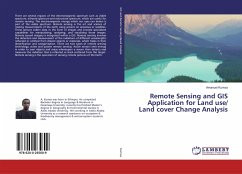
There are several regions of the electromagnetic spectrum such as visible spectrum, infrared spectrum and microwave spectrum, which are useful for remote sensing. The electromagnetic energy which our eyes can detect is part of the visible spectrum. Remote sensing is the art and science of making measurements of the earth using sensors on airplanes or satellites. These sensors collect data in the form of images and provide specialized capabilities for manipulating, analyzing, and visualizing those images. Remote sensed imagery is integrated within a GIS. Remote sensing involves the detection an...
There are several regions of the electromagnetic spectrum such as visible spectrum, infrared spectrum and microwave spectrum, which are useful for remote sensing. The electromagnetic energy which our eyes can detect is part of the visible spectrum. Remote sensing is the art and science of making measurements of the earth using sensors on airplanes or satellites. These sensors collect data in the form of images and provide specialized capabilities for manipulating, analyzing, and visualizing those images. Remote sensed imagery is integrated within a GIS. Remote sensing involves the detection and measurement of the radiations of different wavelengths reflected or emitted from distant objects or materials, which helps in their identification and categorization. There are two types of remote sensing technology, active and passive remote sensing. Active sensors emit energy in order to scan objects and areas whereupon a sensor then detects and measures the radiation that is reflected or back scattered from the target. Remote sensing is the operation of sensing remote pictures of the Earth.


