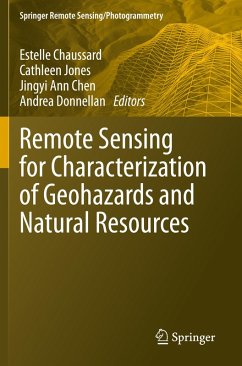
This book provides insights from a geoscientist's perspective into the benefits and the potential of remote sensing methods to address problems with a high social impact: identifying the drivers of geohazards and developing new methods for monitoring natural resources. The fields covered include volcanic hazards, seismic hazards, landslide hazards, land subsidence hazards and monitoring of natural resources through the use and combination of various remote sensing techniques and modelling approaches. This book should spark collaborations and encourage readers to think beyond disciplines or…mehr
This book provides insights from a geoscientist's perspective into the benefits and the potential of remote sensing methods to address problems with a high social impact: identifying the drivers of geohazards and developing new methods for monitoring natural resources. The fields covered include volcanic hazards, seismic hazards, landslide hazards, land subsidence hazards and monitoring of natural resources through the use and combination of various remote sensing techniques and modelling approaches. This book should spark collaborations and encourage readers to think beyond disciplines or techniques, as well as enable readers to build their own workflow depending on their study of interest. It provides a much-needed comprehensive review of recent advances that remote sensing methods have brought to geohazards and resources research. It is unique in the way that it unifies geohazards and natural resources research to highlight cross-field advancements and potential areas for multiple fields of science to collaborate.
The book intends to provide both a basic understanding of the remote sensing methods used in geohazards and natural resources sciences, with appropriate referencing for readers wishing to further their technique-specific learning, and a detailed application of these methods to a variety of sustainability problems. It aims at providing the reader with workflows for combining multiple techniques with demonstrated results in a variety of disciplines. This approach makes the book useful for both students learning about geohazards and resources, learning about remote sensing methods, and for researchers intending to expand their skill set using methods that have been applied to other fields. This book provides an introduction to each remote sensing method with references for in-depth technical learning which will benefit students in Remote Sensing courses.
Die Herstellerinformationen sind derzeit nicht verfügbar.
Autorenporträt
Estelle Chaussard, Ph.D., is a Lead Research Scientist in the Structures and Geohazards Research group of commercial property insurer FM Global. Her work advances Natural Hazards characterization and champions effective use of satellite data for both rapid disaster response and long-term monitoring. Over her 15 years of research experience, she has led peer-reviewed publications in the fields of climate-change, water-sustainability, hydrology, earthquake science, volcanology, and satellite techniques. Estelle received a B.S. (2008) and a M.S. (2010) in Earth Sciences from the University of Montpellier (II), France, and a Ph.D. in Geophysics (2013) from the University of Miami, USA. Prior to joining FM Global, Estelle was a university professor and received funding from NASA and the National Science Foundation (NSF), including the prestigious NSF Career Award. Cathleen E. Jones, Ph.D., is a Senior Research Scientist at the Jet Propulsion Laboratory, California Institute of Technology, where she has worked as a scientist and systems engineer since 2004. Her research focusses on the use of synthetic aperture radar to study natural and anthropogenic hazards, specifically land subsidence, security of critical infrastructure, remote sensing of marine pollution, and improved coastal resiliency. Her recent research as the Deputy Principal Investigator of the NASA Delta-X Earth Venture-Suborbital mission is a cross-disciplinary investigation of the processes controlling land building in deltas. She has served as the Applications Co-Lead of the NASA-ISRO Synthetic Aperture Radar (NISAR) Science Team since 2016, working to enable practical application of SAR methods by operational agencies for monitoring, resource management, and disaster response and risk reduction. She received B.S. (Texas A&M, 1982) and Ph.D. (California Institute of Technology, 1991) degrees in Physics, and is an editor for the American Geophysical Union's Earth and Space Science journal. Awards include two NASA Exceptional Achievement Medals (2014, 2015), and the Remote Sensing and Drought Science Service Award from the California Dept. of Water Resources. Jingyi Ann Chen, Ph.D., has more than 15 years of experience in SAR/InSAR algorithm design for earth system science applications. She received a B.S. degree in geophysics from the University of Science and Technology of China, Hefei, China in 2008; an M.S. degree in electrical engineering in 2012 and a Ph.D. degree in geophysics in 2014 from Stanford University, California, USA. In 2017, she joined the Department of Aerospace Engineering and Engineering Mechanics at The University of Texas at Austin as an assistant professor. Since 2018, she has also served as a faculty member (by courtesy) in the Department of Geological Sciences at UT Austin. She currently leads the Radar Interferometry Group housed in the Center for Space Research. Her group focuses on the development of new satellites, and especially interferometric Synthetic Aperture Radar (InSAR) techniques, for studying natural and induced seismicity, groundwater resources, natural disasters, and permafrost hydrology and carbon storage. Andrea Donnellan, PhD is manager of the Instrument Systems Section at NASA's Jet Propulsion Laboratory where she is also a principal research scientist. Donnellan is on the NISAR science team and led NASA's GeoGateway and QuakeSim projects for over twenty years. She leads NASA's Surface Topography and Vegetation Study and is principal investigator of the QUAKES stereoimaging instrument suite. Donnellan studies earthquakes and crustal deformation combining a variety of geodetic imaging techniques with computational modeling and infrastructure. Donnellan has degrees in Geology (BS Ohio State University, 1986), Geophysics (MS and PhD Caltech 1988 and 1991), and Computer Science (MS University of Southern California, 2003). She held a National Research Council postdoctoral fellowship at NASA's Goddard Space Flight Center from 1991-1993. She was a founding editor of the American Geophysical Union's Earth and Space Science Journal and was President of the American Geophysical Union's Nonlinear Geophysics Section. Donnellan is a fellow of the American Geophysical Union, the American Association for the Advancement of Science, and The Explorers Club. In 1996 she won the Presidential Early Career Award for Scientist and Engineers and in 2012 NASA's Software of the Year Award. Donnellan was a finalist in the astronaut selection process three times. The Donnellan Glacier in Antarctica was named by Advisory Committee on Antarctic Names in 2006 for her work on the Antarctic continent.
Inhaltsangabe
Chapter 1: Enhancing stewardship of Earth through remote sensing.- Part 1: Remote sensing methods in geohazards and resource monitoring.- Chapter 2: The Global Navigation Satellite System (GNSS): Positioning, Velocities, and Reflections.- Chapter 3: Interferometric Synthetic Aperture Radar (InSAR).- Chapter 4: Lidar for geohazard and natural resource characterization.- Chapter 5: Optical Geodesy and the Measurement of Ground Deformation by Image Correlation.- Chapter 6: The Gravity Recovery and Climate Experiment (GRACE).- Chapter 7: Thermal Remote Sensing.- Chapter 8: Multibeam Echosounder.- Part 2: Geohazards - Volcanic.- Chapter 9: Remote sensing of volcano deformation and surface change.- Chapter 10: Gas and thermal emissions of volcanoes.- Chapter 11: Modeling of remote sensing data: common practices, state of the art, and limitations.- Part 3: Geohazards - Volcanic.- Chapter 12: Fault structure from space.- Chapter 13: Rapid characterization of damages.- Chapter 14: The seismic cycle: from observations to models of fault slip.- Part 4: Geohazards - Land subsidence.- Chapter 15: Land subsidence hazards: a case study of Mexico City.- Chapter 16: Quantifying subsidence in tropical peatlands.- Chapter 17: Mining/post-mining surface deformation.- Chapter 18: Sinkholes.- Chapter 19: Natural compaction of sediments.- Chapter 20: Coastal flooding and structure stability.- Part 5: Geohazards - Landslide.- Chapter 21: Landslide hazards.- Chapter 22: Underwater mass wasting.- Part 6: Natural resources - Water.- Chapter 23: Observations of confined aquifer systems.- Chapter 24: Large-scale terrestrial water storage changes sensed by geodesy.- Chapter 25: Bridging the scale gap between ground deformation and gravity: tools for sustainability.- Part 7: Natural resources - Gas and hydrocarbon exploitation.- Chapter 26: Carbon capture and storage.- Chapter 27: Hydraulic fracturing.- Part 8: Future of remote sensing methods.- Chapter 28: Future of remote sensing for geohazards and resource monitoring.- Part 9: Application of remote sensing in other domains of geosciences.- Chapter 29: Space geodetic sensing of atmospheric water vapor and its application.- Chapter 30: Oceans.- Chapter 31: Cryospheric applications of remote sensing: snow water equivalent.
Es gelten unsere Allgemeinen Geschäftsbedingungen: www.buecher.de/agb
Impressum
www.buecher.de ist ein Internetauftritt der buecher.de internetstores GmbH
Geschäftsführung: Monica Sawhney | Roland Kölbl | Günter Hilger
Sitz der Gesellschaft: Batheyer Straße 115 - 117, 58099 Hagen
Postanschrift: Bürgermeister-Wegele-Str. 12, 86167 Augsburg
Amtsgericht Hagen HRB 13257
Steuernummer: 321/5800/1497
USt-IdNr: DE450055826