26,99 €
inkl. MwSt.
Versandkostenfrei*
Versandfertig in 1-2 Wochen
payback
13 °P sammeln
  • Broschiertes Buch

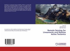
Geologists are continuously facing accessibility problems in carrying field work before reconnaissance related to the area. It is of urgent need to develop remote sensing applications for mitigating the problems faced in field. Scientists throughout the world are busy in developing the most efficient and innovative methods for development and making research easy in Geosciences. The book describes the application of Remote sensing approach in lineament identification and assessing relative active tectonics. Remote sensing and GIS are easy and cost effective methods for taking any geological research in any terrain.…mehr

Produktbeschreibung
Geologists are continuously facing accessibility problems in carrying field work before reconnaissance related to the area. It is of urgent need to develop remote sensing applications for mitigating the problems faced in field. Scientists throughout the world are busy in developing the most efficient and innovative methods for development and making research easy in Geosciences. The book describes the application of Remote sensing approach in lineament identification and assessing relative active tectonics. Remote sensing and GIS are easy and cost effective methods for taking any geological research in any terrain.
Hinweis: Dieser Artikel kann nur an eine deutsche Lieferadresse ausgeliefert werden.
Autorenporträt
Mr. Umair ALi is a Ph.D. candidate in the Departmentof Geology, Aligarh Muslim University, AligarhIndia. Presently, he is working on the Tectonic and Litho-structural study of Intermontane Basin, NW Himalayas.