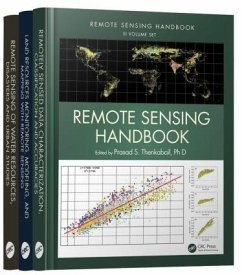
Remote Sensing Handbook - Three Volume Set
Herausgeber: Thenkabail, Prasad
Remote Sensing Handbook - Three Volume Set
Herausgeber: Thenkabail, Prasad
- Broschiertes Buch
- Merkliste
- Auf die Merkliste
- Bewerten Bewerten
- Teilen
- Produkt teilen
- Produkterinnerung
- Produkterinnerung
With more than 100 leading global contributors, this book is the most comprehensive documentation of the scientific and methodological advances that have taken place in understanding remote sensing data, methods, and applications over last 50 years. In a very practical way the book demonstrates the experience, utility, methods, and models used in studying a wide array of Land applications.
Andere Kunden interessierten sich auch für
![Environmental Modelling with GIS and Remote Sensing Environmental Modelling with GIS and Remote Sensing]() Andrew Skidmore (ed.)Environmental Modelling with GIS and Remote Sensing120,99 €
Andrew Skidmore (ed.)Environmental Modelling with GIS and Remote Sensing120,99 €![Remote Sensing of Protected Lands Remote Sensing of Protected Lands]() Remote Sensing of Protected Lands95,99 €
Remote Sensing of Protected Lands95,99 €![Remote Sensing of Soil Salinization Remote Sensing of Soil Salinization]() Remote Sensing of Soil Salinization94,99 €
Remote Sensing of Soil Salinization94,99 €![Working with Map Projections Working with Map Projections]() Fritz KesslerWorking with Map Projections112,99 €
Fritz KesslerWorking with Map Projections112,99 €![New Frontiers in Urban Analysis New Frontiers in Urban Analysis]() New Frontiers in Urban Analysis94,99 €
New Frontiers in Urban Analysis94,99 €![Tropical Dry Forests in the Americas Tropical Dry Forests in the Americas]() Tropical Dry Forests in the Americas93,99 €
Tropical Dry Forests in the Americas93,99 €![Effective Risk Communication Effective Risk Communication]() Effective Risk Communication82,99 €
Effective Risk Communication82,99 €-
-
-
With more than 100 leading global contributors, this book is the most comprehensive documentation of the scientific and methodological advances that have taken place in understanding remote sensing data, methods, and applications over last 50 years. In a very practical way the book demonstrates the experience, utility, methods, and models used in studying a wide array of Land applications.
Hinweis: Dieser Artikel kann nur an eine deutsche Lieferadresse ausgeliefert werden.
Hinweis: Dieser Artikel kann nur an eine deutsche Lieferadresse ausgeliefert werden.
Produktdetails
- Produktdetails
- Verlag: Taylor & Francis Ltd (Sales)
- Seitenzahl: 2200
- Erscheinungstermin: 17. November 2015
- Englisch
- Abmessung: 289mm x 225mm x 129mm
- Gewicht: 7200g
- ISBN-13: 9781482218015
- ISBN-10: 1482218011
- Artikelnr.: 40922660
- Herstellerkennzeichnung
- Libri GmbH
- Europaallee 1
- 36244 Bad Hersfeld
- gpsr@libri.de
Dr. Prasad S. Thenkabail is a well known global expert in remote sensing and spatial sciences. Currently, works as a Research Geographer-15 with the U.S. Geological Survey (USGS). Dr. Thenkabail has conducted pioneering scientific research work in two major areas: Hyperspectral remote sensing of vegetation; Global Irrigated and Rainfed Cropland Mapping. His research papers have won three American Society of Photogrammetric Engineering and Remote Sensing (ASPRS) awards: (a) 2015 ERDAS award for best scientific paper (second author), (a) 2008 ASPRS President's award (first author), (b) 1994 Autometric Award (first author). He is the Editor-in- Chief of seminal books (Publisher: Taylor and Francis Inc.): (a) three volume (including this), 82 Chapter, Remote Sensing Handbook (November 2015), (b) Hyperspectral Remote Sensing of Vegetation (2012), and (c) Remote Sensing of Global Croplands for Food Security (2009). He is the Editor-in-Chief of Remote Sensing Open Access Journal and is on the editorial board of Remote Sensing of Environment, and ISPRS Journal of Photogrammetry and Remote Sensing. Prasad has work experience in 25+ Countries including working in key remote sensing research\leadership positions @ the International Water Management Institute (IWMI), International Institute of Tropical Agriculture (IITA), Yale Center for Earth Observation (YCEO), and the Indian National Remote Sensing Agency. He was selected by NASA and USGS as a member of Landsat Science Team Member (2007-20011), and was a scientific advisory board member of Rapideye (2001). John G. Lyon has conducted scientific and engineering research and administrative functions throughout his career. He is formerly the senior physical scientist in the U.S. Environmental Protection Agency's Office of Research and Development (ORD) and Office of the Science Advisor in Washington, DC, where he co-led work on the Group on Earth Observations and the USGEO subcommittee of the Committee on Environment and Natural Resources, and research on geospatial issues. Lyon was director of ORD's Environmental Sciences Division for approximately eight years. He was educated at Reed College in Portland, Oregon, and the University of Michigan in Ann Arbor.
Foreword
Editor
Contributors
Section I:?Hydrology and Water Resources
1. Remote Sensing Technologies for Multiscale Hydrological Studies: Advances and Perspectives
2. Groundwater Targeting Using Remote Sensing
Section II:?Water Use and Water Productivity
3. Remote Sensing of Actual Evapotranspiration from Croplands
4. Water Productivity Studies from Earth Observation Data: Characterization
Modeling
and Mapping Water Use and Water Productivity
Section III:?Floods
5. Flood Monitoring Using the Integration of Remote Sensing and Complementary Techniques
6. Flood Studies Using Synthetic Aperture Radar Data
Section IV: Wetlands
7. Remote Sensing of Mangrove Wetlands
8. Wetland Mapping Methods and Techniques Using Multisensor
Multiresolution Remote Sensing: Successes and Challenges
9. Inland Valley Wetland Cultivation and Preservation for Africa's Green and Blue Revolution Using Multisensor Remote Sensing
Section V: Snow and Ice
10. Remote Sensing Mapping and Modeling of Snow Cover Parameters and Applications
Section VI:?Nightlights
11. Nighttime Light Remote Sensing: Monitoring Human Societies from Outer Space
Section VII:?Geomorphology
12. Geomorphological Studies from Remote Sensing
Section VIII:?Droughts and Drylands
13. Agricultural Drought Detection and Monitoring Using Vegetation Health Methods
14. Agricultural Drought Monitoring Using Space-Derived Vegetation and Biophysical Products: A Global Perspective
15. Remote Sensing of Drought: Emergence of a Satellite-Based Monitoring Toolkit for the United States
16. Regional Drought Monitoring Based on Multisensor Remote Sensing
17. Land Degradation Assessment and Monitoring of Drylands
Section IX: Disasters
18. Disasters: Risk Assessment
Management
and Post-Disaster Studies Using Remote Sensing
19. Humanitarian Emergencies: Causes
Traits
and Impacts as Observed by Remote Sensing
Section X: Volcanoes
20. Remote Sensing of Volcanoes
Section XI:?Fires
21. Satellite-Derived Nitrogen Dioxide Variations from Biomass Burning in a Subtropical Evergreen Forest
Northeast India
22. Remote Sensing-Based Mapping and Monitoring of Coal Fires
Section XII:?Urban Areas
23. Urban Growth Mapping of Mega Cities: Multisensor Approach
24. Latest High-Resolution Remote Sensing and Visibility Analysis for Smart Environment Design
Section XIII:?Summary
25. Remote Sensing of Water Resources
Disasters
and Urban Areas: Monitoring
Modeling
and Mapping Advances over the Last 50 Years and a Vision for the Future

