87,50 €
inkl. MwSt.
Versandkostenfrei*
Versandfertig in über 4 Wochen
  • Broschiertes Buch

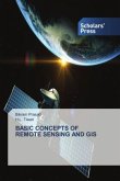
This book explores the world of remote sensing technology, offering comprehensive insights into its principles, data acquisition methods, advanced processing techniques, and diverse applications. It covers the basics of remote sensingsuch as the foundational principles and data acquisition techniques, image pre-processing, such as noise removal, radiometric corrections, and image fusion, and advanced classification techniques like machine learning algorithms including neural networks and support vector machines. Finally, it discusses disaster management and agriculture, demonstrating how…mehr

Produktbeschreibung
This book explores the world of remote sensing technology, offering comprehensive insights into its principles, data acquisition methods, advanced processing techniques, and diverse applications. It covers the basics of remote sensingsuch as the foundational principles and data acquisition techniques, image pre-processing, such as noise removal, radiometric corrections, and image fusion, and advanced classification techniques like machine learning algorithms including neural networks and support vector machines. Finally, it discusses disaster management and agriculture, demonstrating how remote sensing methods are revolutionizing fields such as disaster response and agricultural monitoring. Professionals, researchers, and students involved in environmental sciences, geography, urban planning, and disaster management will benefit from these topics. FEATURES: * Explores cutting-edge advanced classification techniques like machine learning algorithms including neural networks and support vector machines * Covers both the theoretical principles and also practical data acquisition techniques, image pre-processing, noise removal, radiometric corrections, and image fusion * Demonstrates how remote sensing methods are revolutionizing fields such as disaster response and agricultural monitoring * Includes companion files for downloading with full color images from the text
Hinweis: Dieser Artikel kann nur an eine deutsche Lieferadresse ausgeliefert werden.
Autorenporträt
P. K. Garg holds a PhD in remote sensing (University of Bristol) and is a professor of civil engineering, specializing in geomatics engineering. He is a member of the advisory committee of CSSTEAP (Centre for Space Science and Technology Education in Asia and the Pacific).