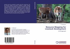
Resource Mapping for Livestock Development
A GIS Approach
Versandkostenfrei!
Versandfertig in 6-10 Tagen
51,99 €
inkl. MwSt.

PAYBACK Punkte
26 °P sammeln!
Livestock cannot be considered in isolation from their environment. The link between livestock and human populations, common property resources and cropping necessitate for an effort to quantify and map these relationships, with improved Geographic Information System (GIS) capabilities. This book deals with the application of GIS in mapping the resources of livestock production. Step-wise procedure for creating GIS maps, using Geomedia 6.0, is a special feature of this book. Besides analysing the spatio-temporal growth of livestock sector, in terms of population and production dynamics, the bo...
Livestock cannot be considered in isolation from their environment. The link between livestock and human populations, common property resources and cropping necessitate for an effort to quantify and map these relationships, with improved Geographic Information System (GIS) capabilities. This book deals with the application of GIS in mapping the resources of livestock production. Step-wise procedure for creating GIS maps, using Geomedia 6.0, is a special feature of this book. Besides analysing the spatio-temporal growth of livestock sector, in terms of population and production dynamics, the book also prescribed methods for developing zone-wise models for overall progress of the livestock sector. The book will be very much useful to the livestock policy makers, GIS specialists, livestock economists and animal researchers.


