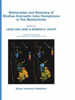
Restoration and Recovery of Shallow Eutrophic Lake Ecosystems in The Netherlands
Proceedings of a conference held in Amsterdam, The Netherlands, 18-19 April 1991
Herausgegeben von Liere, Louis van; Gulati, Ramesh D.
Versandkostenfrei!
Versandfertig in 1-2 Wochen
153,99 €
inkl. MwSt.

PAYBACK Punkte
77 °P sammeln!
are considered quantitatively and qualitatively and within awiderangeofspatialand time scales. The hydrological studies in the interdisciplinary The present hydrological situation in the area workgroup WQL (Water Quality research Loos is the result of a complex sequence of events of drecht lakes) on restoration of the Loosdrecht natural and man-made origin. The present distri Lakes have been carried from 1982-1988 (Kal bution of nutrients in the water systems of the et al. , 1984; Engelen & Kal, 1985; Kal, 1986). The area can be understood only when the hydrolog aim of the study was to provide...
are considered quantitatively and qualitatively and within awiderangeofspatialand time scales. The hydrological studies in the interdisciplinary The present hydrological situation in the area workgroup WQL (Water Quality research Loos is the result of a complex sequence of events of drecht lakes) on restoration of the Loosdrecht natural and man-made origin. The present distri Lakes have been carried from 1982-1988 (Kal bution of nutrients in the water systems of the et al. , 1984; Engelen & Kal, 1985; Kal, 1986). The area can be understood only when the hydrolog aim of the study was to provide an integrated ical history is traced back. One has to start at the description of the abiotic part of the water sys beginning of the Holocene period and to follow tems and its contribution to thefunctioningofthe up closely the increasing interference of man. aquatic ecosystems in the Loosdrecht Lakes (En Overthelastcenturies and decades man has been gelen, 1986). changing the flow systems around the lakes by Theresults hadto servethefollowingpurposes: digging peat, draining lakes, extracting ground water, maintaining fixed surface water levels in General framework. The integrated hydrological polders and transferring water from adjacent riv studies had to provide a general frame of refer ers and canals to supply the lakes to maintain ence for the other project participants represent their water levels.


