23,99 €
inkl. MwSt.

Versandfertig in 6-10 Tagen
  • Broschiertes Buch

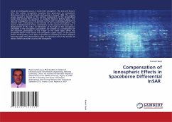
This book is an original piece of work about how SAR Interferometry could be used to measure post-earthquake shock's deformations. It will give reader a quick approach of how Linux based DORIS software could be used in this regard and how successful conclusions could be achieved using image analysis and geological observations. Readers are expected to have a basic geological, computational, and remote sensing knowledge for better understanding of explained methodologies. This book is an intermediate technical book for geologists, earthquake scientists and computer programmers.

Produktbeschreibung
This book is an original piece of work about how SAR Interferometry could be used to measure post-earthquake shock's deformations. It will give reader a quick approach of how Linux based DORIS software could be used in this regard and how successful conclusions could be achieved using image analysis and geological observations. Readers are expected to have a basic geological, computational, and remote sensing knowledge for better understanding of explained methodologies. This book is an intermediate technical book for geologists, earthquake scientists and computer programmers.
Autorenporträt
Mohammed Zia has a doctorate in GeoSpatial technologies with 7+ years of academic experience in the field of Location Based-, Vehicle Routing-Services, Land Use/Land Cover monitoring, and Environmental Sciences. His background is in Geology and Remote Sensing. Currently he is working on Government funded Research and Development projects.